Trip duration: 4 days | Approx cost: £300 | When: Summer
Doinit factor: A strenuous hike over some amazing scenery and a chance to see a glacier!
There’s a lot more to Bavaria than beer, bratwurst and the local population sporting their traditional lederhosen (for men) and dirndl (for women) dress. For history buffs there are castles, for skiers there are plenty of slopes and for hikers or climbers, well, you have the Zugspitze which, at 2,962 metres, marks Germany’s highest point.
There are a handful of routes to the summit from both Austria and Germany – of course if it’s just the view you’re after then you can get a cable car up to the top in about 10 minutes (49.50 Euro return). Two of the more popular routes start on the German side. Höllental (Valley of Hell) is the preferred option for many. It’s a shorter, more direct route and is said to be more interesting; what makes it so interesting is that you’ll need crampons to cross the Höllentalferner Glacier, bridge the odd crevasse and the route requires the use of a harness to negotiate a ‘via ferrata’ (Italian for iron road) or more appropriate considering our location, a ‘klettersteig’ (German for climbing path).
With this in mind (and taking our limited experience with crampons and harnesses into account) we decide to take the longer, and probably more off the beaten track, route via the Reintal valley. In the days preceding our trip, we told people of our intended route, only to be met with pretty much the same response each time – “Do you realise how long it takes?” followed by, “You know there are huts where you can sleep along the way”. Indeed we are well aware that this route can take over 10 hours and, even more pressingly, we’re aware that the last cable car down is about 4.30pm, so we know it’s going to be a very early start.Our journey starts in the Bavarian town of Garmisch-Partenkirchen, or simply (though incorrectly) Garmisch. Wonderfully surrounded by alpine landscape, this place has a real charm about it. Typical Bavarian lodges, their balconies lined with colourful flowers, provide a lovely backdrop for a walk around town. Even at the height of summer it’s easily to imagine what a magical winter wonderland this place must be.
Accommodation and services are plentiful. We stay at the appropriately named Hostel 2962 – the height of the peak we’ve come to summit.Following a 15-minute walk from our hostel, by 5am we find ourselves approaching the 1936 Winter Olympic stadium, where the trail officially begins. Our open space quickly disappears as the path nestles between a rocky wall and the fast flowing river. Before we know it we’re in a deep and narrow canyon cut into the surrounding rock, water roaring below through its narrow base, with water falling from the walls above – this is truly an amazing display of white water and vegetation far above you. The paths are cut into the wall and in parts lead through small tunnels alongside the water. The canyon twists and turns in the dawn twilight, allowing just a fraction of the light to penetrate through. Just being in the presence of such energy is enough to get our hearts pounding and fully wake us from our early morning daze.
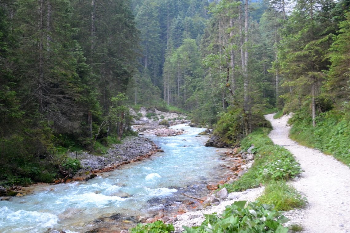
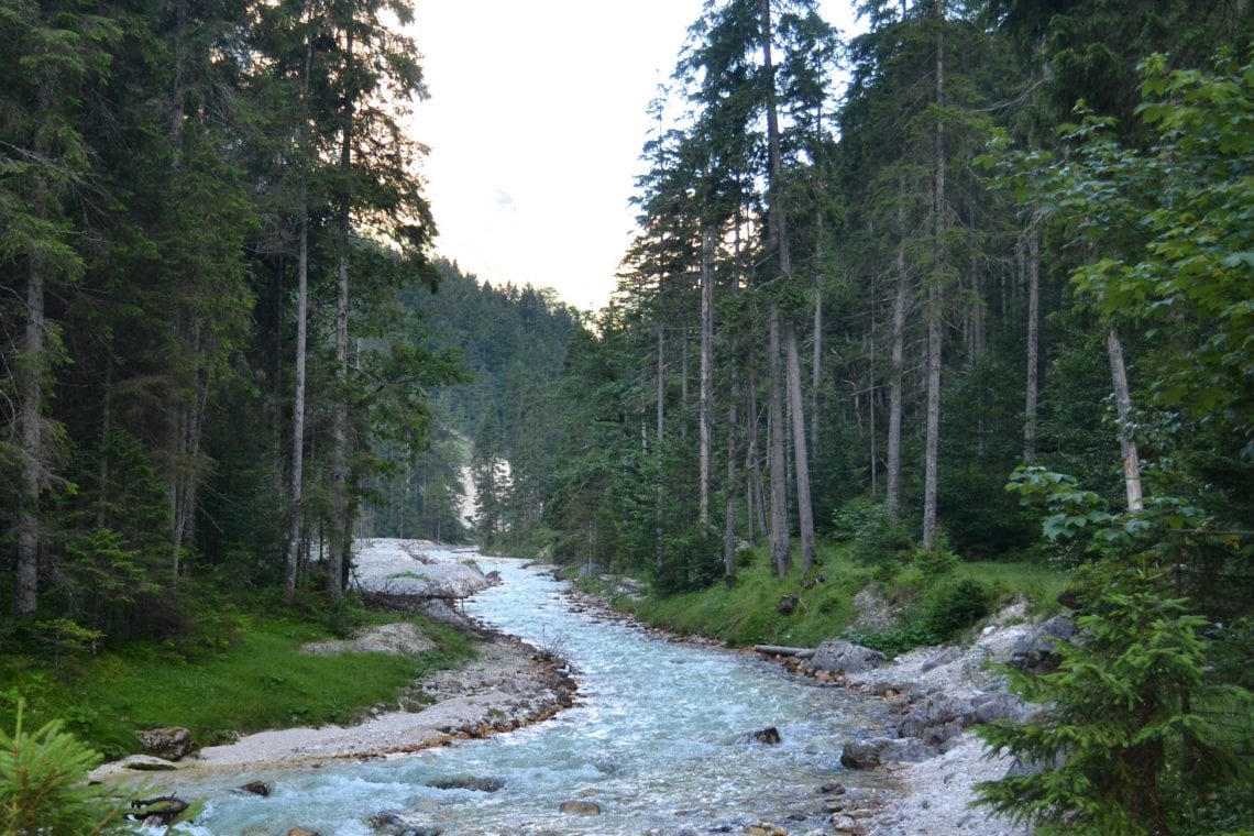
Above: The trail starts with a hike through a canyon before opening up to a valley with fast flowing stream
It’s really tempting to stick around and play with different shutter speeds on our camera (and attempt to hold it steady) but we’ve got a strict time scale to stick to. We’ve a long day ahead of us and the last thing we want is to get to the top of the peak, only to find we’ve missed the last cable car back down in 11 hours’ time.
It’s not long before we’re back in the open; the river opens up and slows down, the surrounding walls begin to widen to reveal a forested valley. The hike from here on could be considered quite leisurely – if we’d not been on this time scale. For the first couple of hours the trek takes us over a well-defined gravel path. Gradually the path rises and falls again, running alongside the lush green forested valley walls before redirecting back to the fast flowing river. Occasionally a bridge takes us over to the other bank then back again. The dark of the early morn has lifted, but we’re sheltered from direct sunlight by the valley walls, and the air remains refreshing cool. We keep up the pace; hardly noticing the subtle narrowing of the path as our team naturally falls in line and makes its way through the depths of this marvellous valley.
Before we know it we’ve gained some altitude and come across a beautiful naturally formed pool that is filled by a small stream. The crystal clear body of water encased in the white smoothed rock provides an opportunity to replenish our water supply. For Dan the find is too difficult to resist as he strips down and jumps in to cool off in the near freezing water. A few photos are taken of this picturesque and pristine landscape, pool in forefront and meandering river glimmering in the sunlight below.
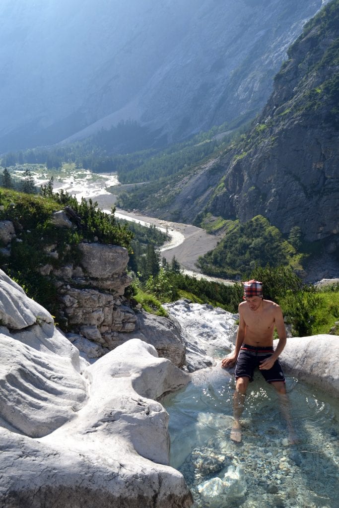
Above: Dan cooling | Looking ahead at a steep climb | Looking back at wear we’ve come from and seeing two lone hikers
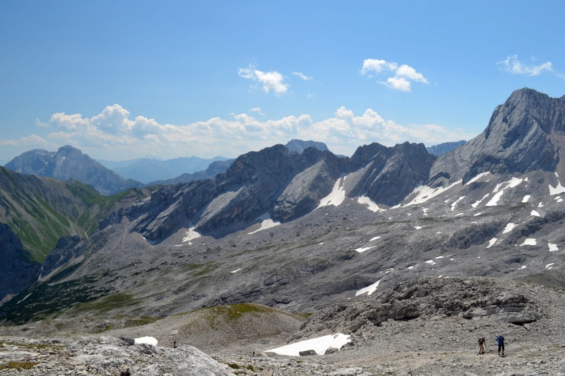
By now most of the vegetation is far below us; we’re surrounded by a world of greys, steep valley walls either side – this place seems remarkably barren. For now at least it seems that we’ve left the steepest section behind, less switchbacks and a more gradual route leads us slowly higher. It’s necessary to cross patches of snow as we make our way to the Zugspitzplatt, the plateau below the summit, which in the winter is popular with skiers.
It’s eerily silent en route until the ringing of bells from sheep and goats meets our ear drums. There are hundreds from the flock basking in the sun, stubbornly not willing to move out of a hiker’s way. Almost two hours from the last hut we passed we’re coming up to a horse-shoe ridged wall which towers above us from all directions (except from where we’ve come). In the distance we see buildings and a relatively large number of people criss crossing the plateau in all directions; the isolation we’ve felt until now dissipates. High above I can make out the summit building, our goal, though at this moment I’m not entirely sure how the route will lead us up there. Progress up the steep rocky switch backs is slow. Respite from the high sun is non-existent, it’s hot and we’re going through a lot of water. The journey is long and tedious, and altitude is gaining steeply. In front of us we can only see the rocky route, but behind us lies the amazing view of the valley through which we’ve passed.
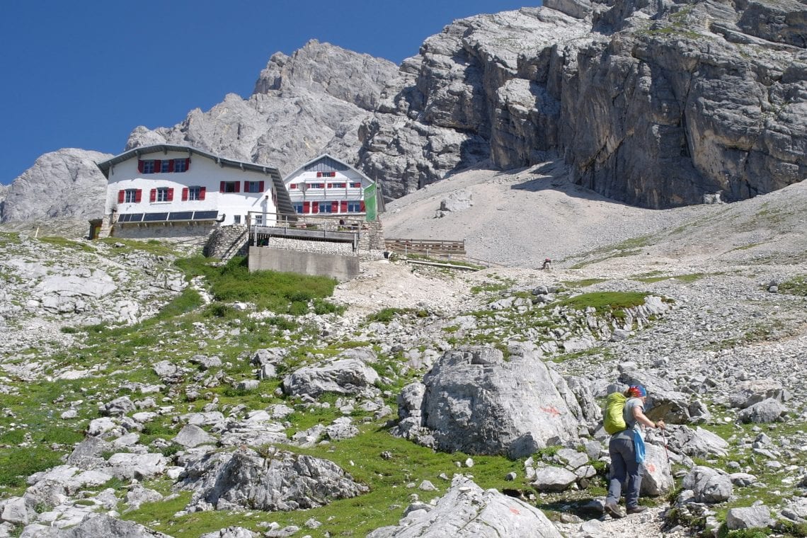
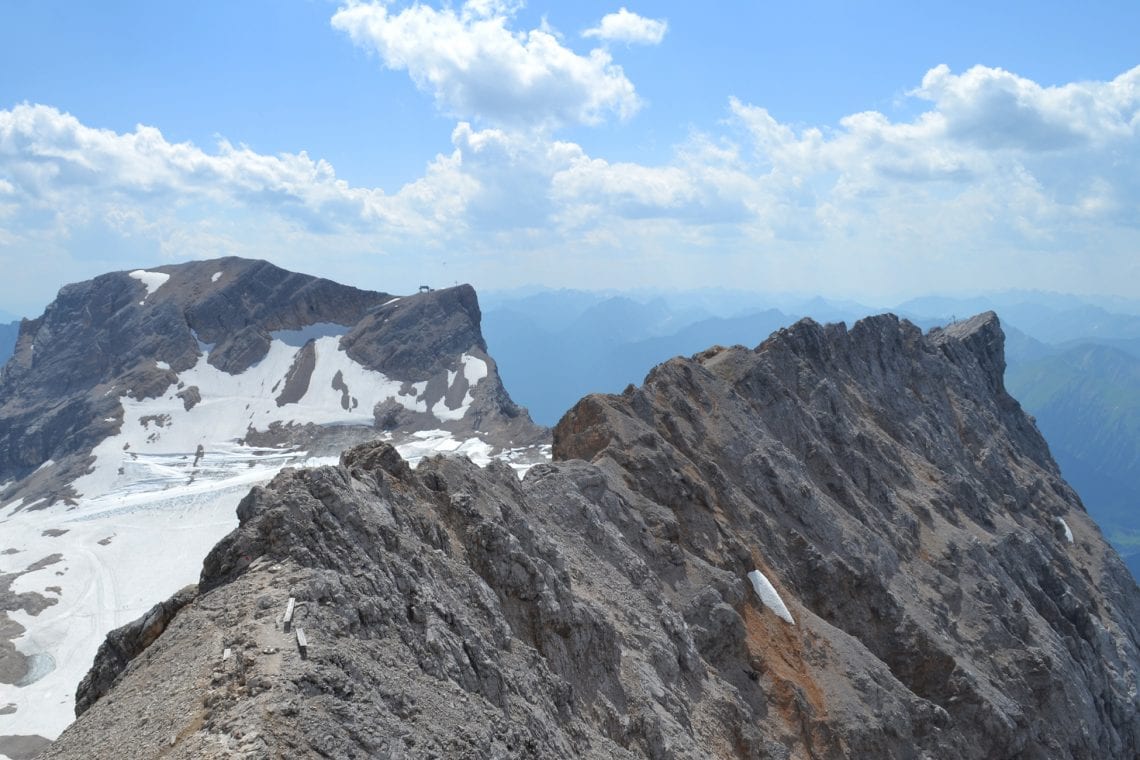
Above: Approaching the Knor Hut | The ridge looks daunting | Looking back down at the ski resort below
After what seems like forever in the blasting sun, surprisingly we come to a small pipe emerging from the rock offering ice cool water that’s running into a wooden trough. I bend over and dunk my entire head in to cool of, and take a seat next to a German couple with a map; they offer me a biscuit and inform me that it’s only 45 minutes or so till the next hut. Cooled off we continue along the rocky ill-defined route, keeping our eyes open for red painted markers every few metres signalling the best way to proceed. Finally a building begins to come into view – first the roof then walls, followed by people on the veranda. We’ve made it to the Knorr Hut. It’s mentally rewarding to finally to pass some form of marker. Here we sit, order large cola’s and open up our sandwiches, enjoying a rest for 30 minutes. As my eyes close I can feel my body insisting it’s nap time but I know that’s not really an option for us. It’s incredibly hard to set off again, but essential. We’ve made good time but depending on what’s ahead of us, this could easily be reversed.
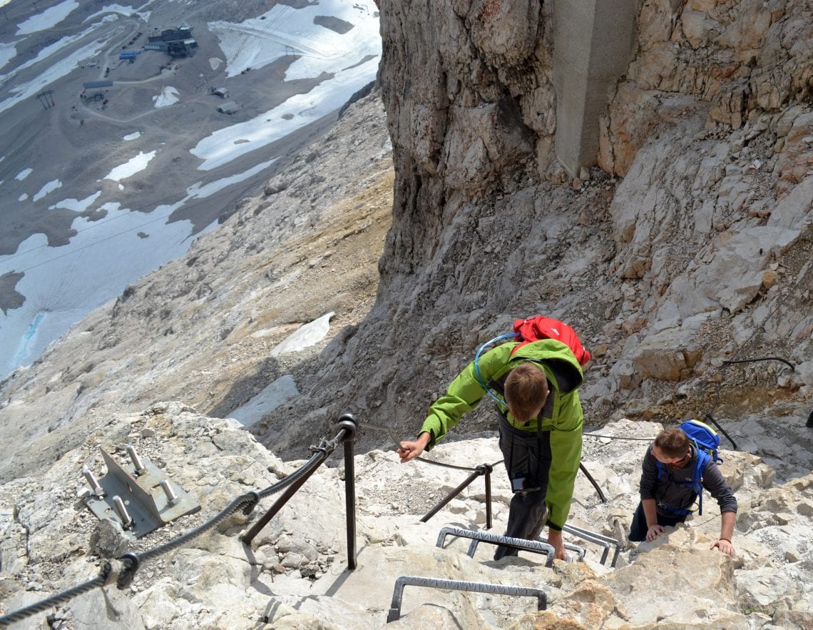
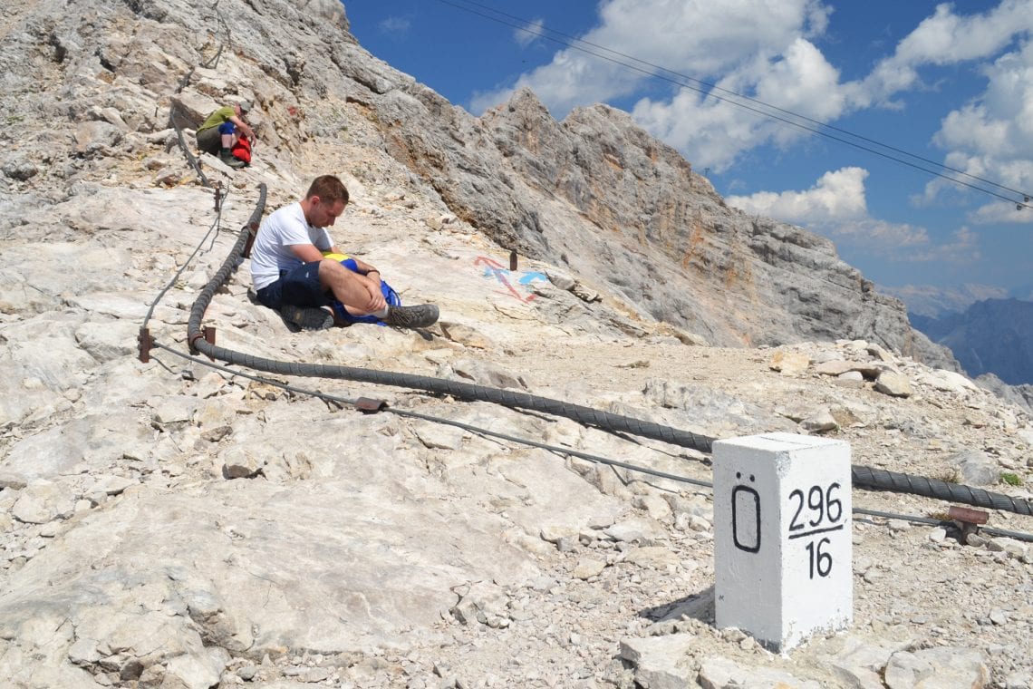
Above: The Zugspitze plateau | Dan climbing up the ladders near the top | Andy taking a break on the ridge
Within about 45 minutes we come to a junction in our route. Left lead to a cable car which could take us up to the summit in 5 minutes; right, we climb. We’ve been at it for over 8 hours. I’m exhausted, soaked with sweat and almost mentally defeated. Right now it’s so easy to cheat, so tempting to get the cable car up to the summit and for a moment I feel my body stepping in the direction with the cable car station and ski hub, but we’ve come this far and eventually I make my way along the track which will take us to the summit. The climb is along an incredibly steep and loose scree slope and more dreaded switch backs, the rocks dry and dusty and with every slip the unleashed dust blows in my face. Height is gained and below us we see the hustle and bustle of the plateau. Though not immediately obvious, if you know where to look you’ll see the Schneefernerkopf glacier which lies on the north back ridge wall of the plateau. The scree is climbed to get to the solid rocky ridge section. While I’m delighted with the prospect of solid footing, it’s pretty exposed and via feratta, the iron rope, is used. I take five, witness a few climbers attach their harness on to the iron rope, take a gulp of water and move on towards the final ridge section (no harness).
It’s not long before I ease into a stride, constantly running my hand along the iron rope in case I begin to feel my feet give way. For the first time in hours I have a sense of making real progress. The iron rope is a great confidence booster, perhaps even providing a false sense of security, as I’m not sure if after all these hours my reaction time would be adequate should I begin to fall. Even if it were, strength would probably fail me at this point. There are a few sections where metal spikes in the rock must be crossed but these are straightforward and easily negotiated if you’ve a head for heights.
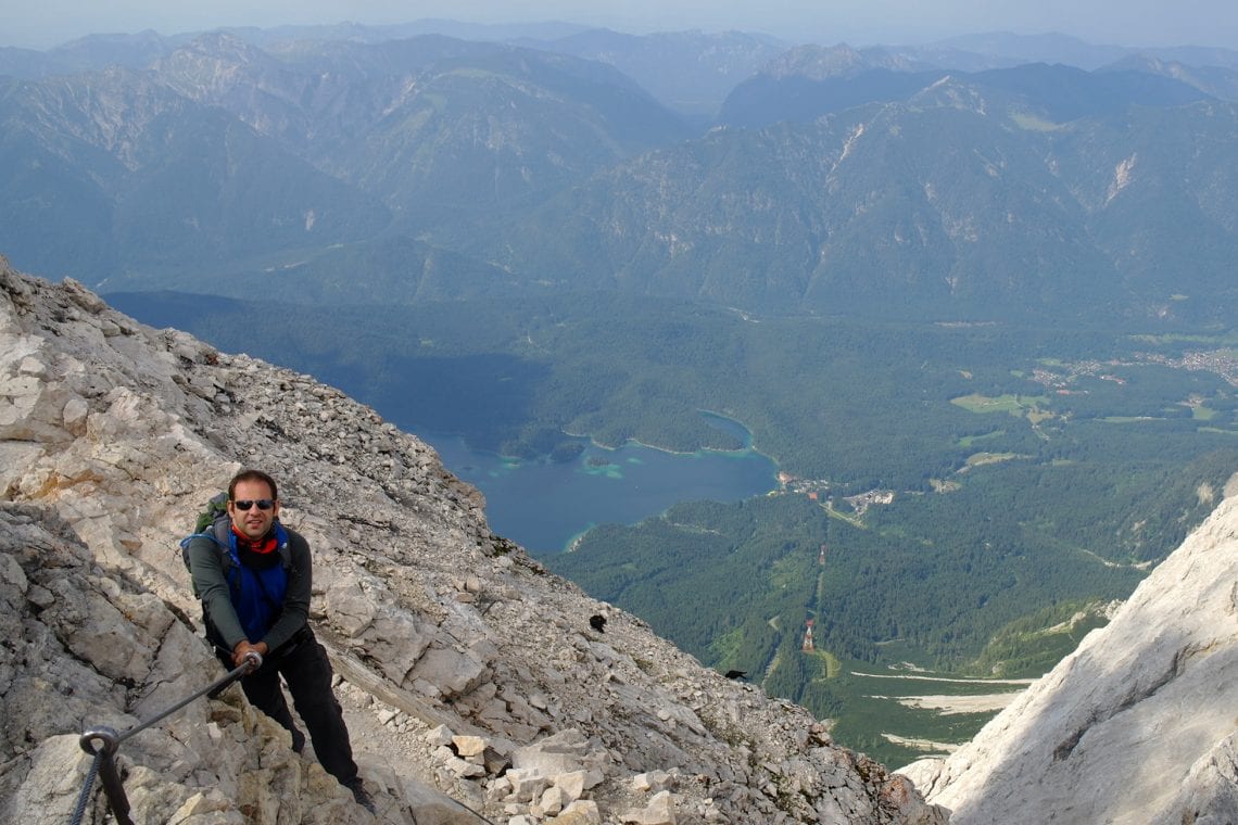
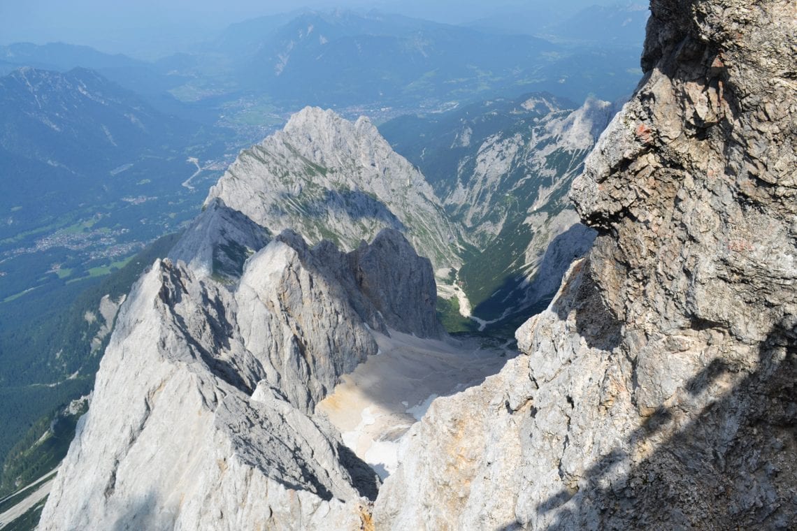
Above: Maz climbing up the final section | One of the three glaciers found on the Zugspitse
The via ferrata zig-zags up to the exposed ridge, which marks the border between Austria and Germany with a white demarcation post every few metres. The views are breath-taking here, and for the first time we can see the lands beyond the mountains, past the valley and ridge walls which confined our view until now. The final 20 minutes on the ridge are spectacular, but still our exhaustion takes its toll, and the summit buildings become larger as we approach. I conclude that with the right conditions and the right footwear you’ll be fine on this section. Walking along the ridge is exhilarating, it’s not as narrow as I’d imagined and at times I even let my hand go from the iron rope. After a little over 10 hours I finally set foot on the first step which takes me up to a complex build atop this mighty mountain. The summit buildings are a real feat of engineering. Together they almost resemble a villain’s lair from a Bond film. Restaurants, bars, shops, even accommodation in the form of the Münchner Haus hut are all available here. Much of the exteriors are viewing platforms, and wow what a view they offer. The surrounding peaks and ridges are spectacular; Lake Eibsee is stunningly beautiful in its deep blue glory.
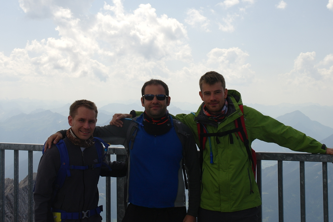
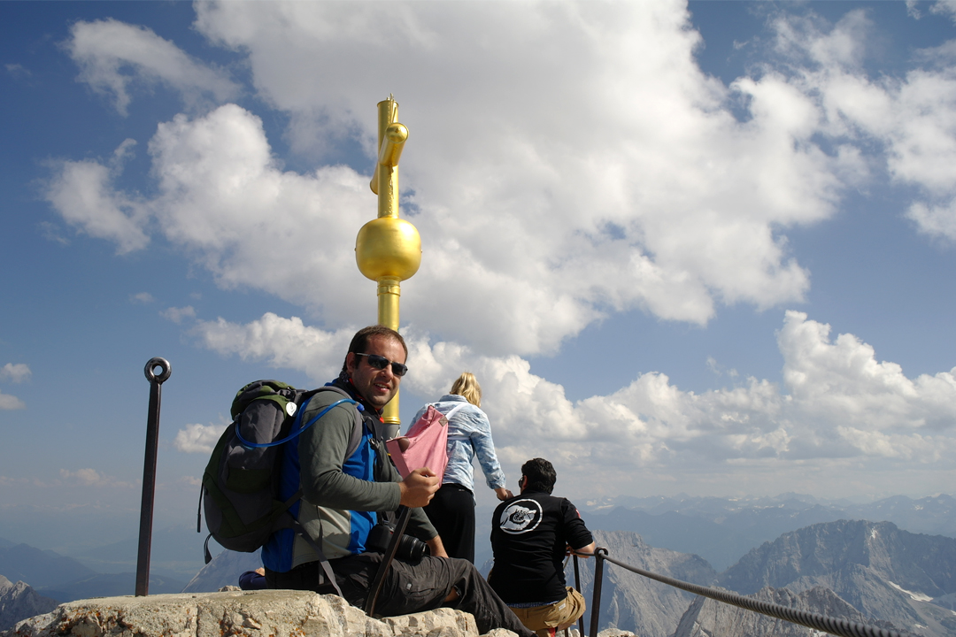
Above: We made it to the top of Germany
WHERE TO STAY
- We stayed at Hostel 2962
USEFUL LINKS
- Info on the mountain huts: Alpine Club Munich & Oberland
- Zugspitse official website