Trip duration: 4 days | Approx cost: £220 | When: Weekender between May – Sep
Doinit factor: How often do you get to stand on a mountain peak with each foot in a different country?
Forming a natural border between the countries of Poland and Slovakia is the magnificent Tatra mountain range and Poland’s highest peak, Mt Rysy at 2,503 meters. The peak is right on the boundary of these two nations with hiking trails leading to its summit from either country. Somewhat bemusingly, those approaching from the Slovak side can reach the highest mountain in Poland without ever really hiking in Poland, and that’s exactly what our plan is.
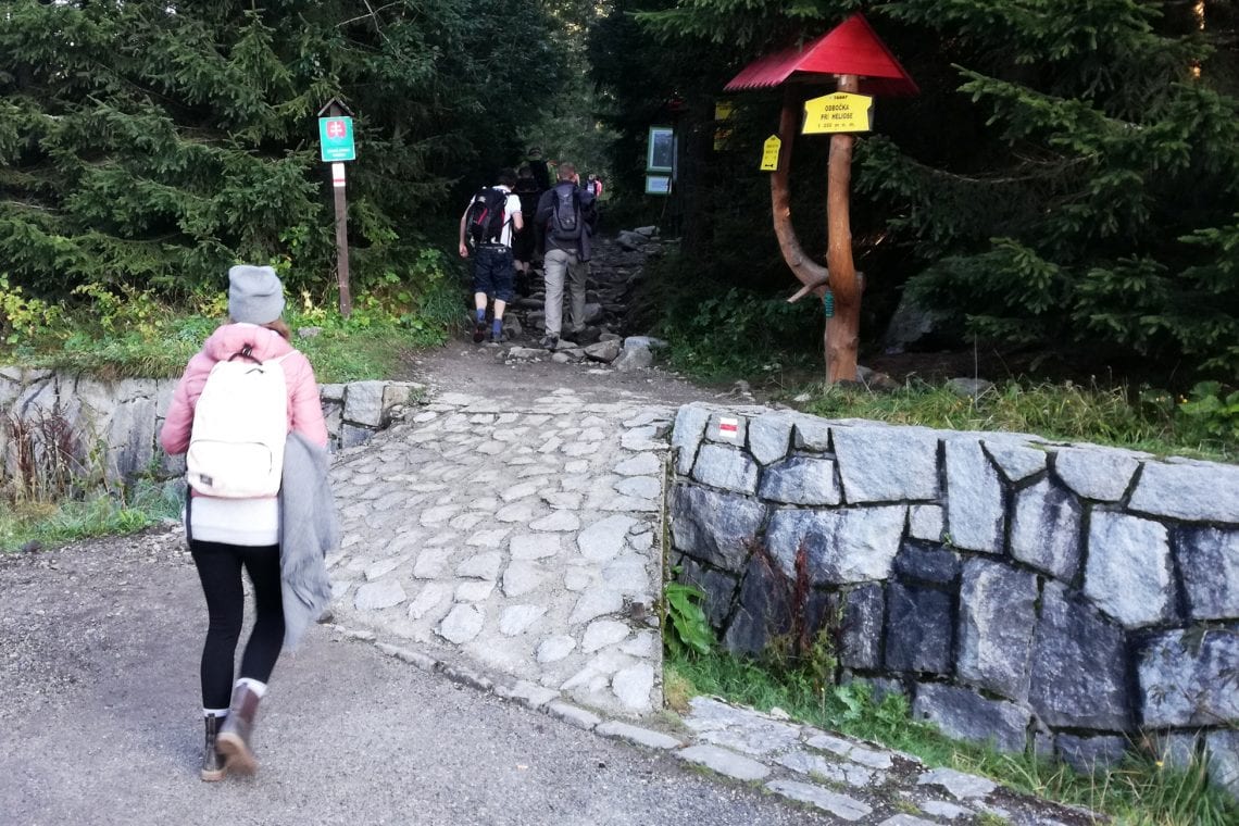
We land at the small airport at Poprad, Slovakia and make our way to our base for the weekend, the ski resort town of Štrbské Pleso. It being mid-summer, the place has a somewhat quiet feel, with only a handful of noticeable tourists hikers around. he expectation is that this is going to be a long day so we’re up early. From our accommodation it’s no more than a 15 minute walk to the trail head. A rocky path steers us through the tall alpine woods, the smell is lovely, and I think to myself they can’t make air fresheners this good. Occasionally a break in the vegetation unveils the natural beauty of the area, the landscape carpeted in the thick green forests. The initial part of the route seems rather steep as it runs along the side a valley. Rocks and twisting tree roots cover our path so a lot of concentration is needed to prevent trips or a nasty fall. Not a trail you’d want to do in the dark!
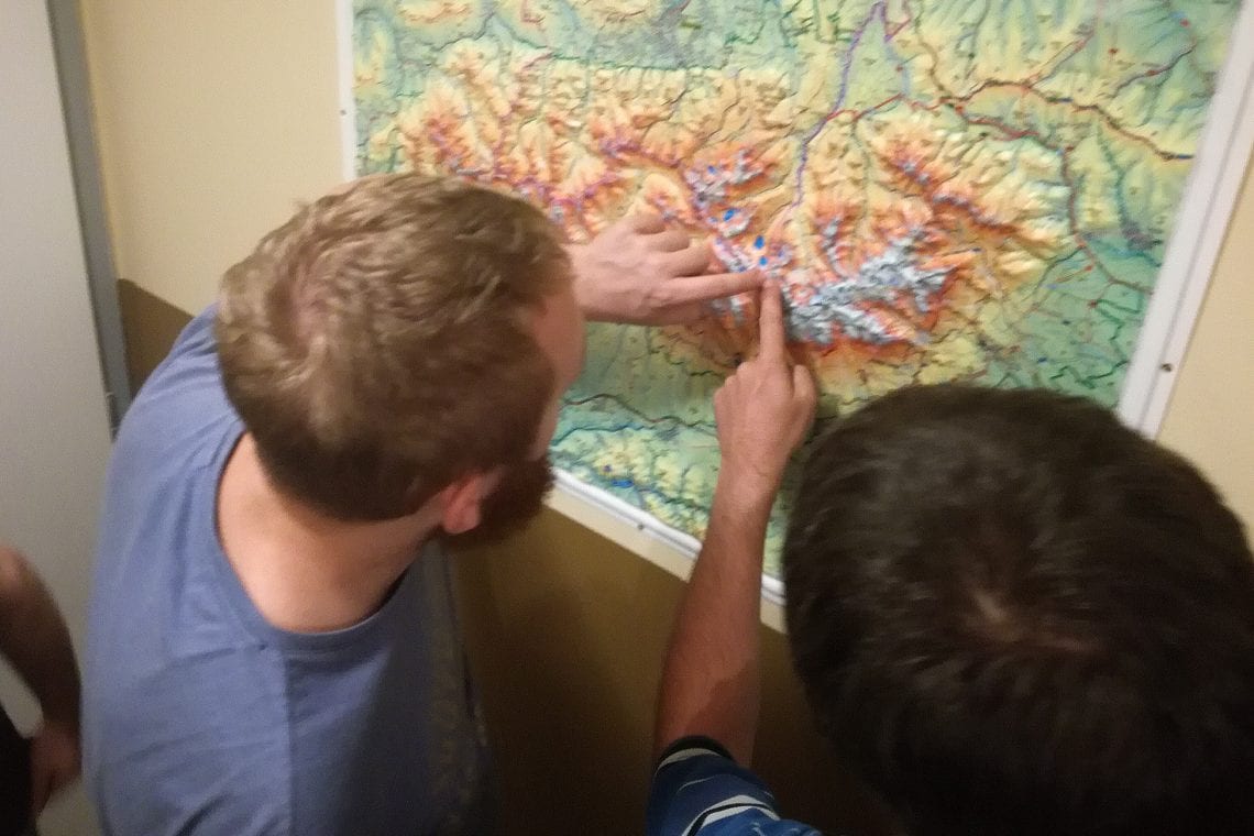
Above: Lee and Jiri planning our route | The trail head leading us trough the forest
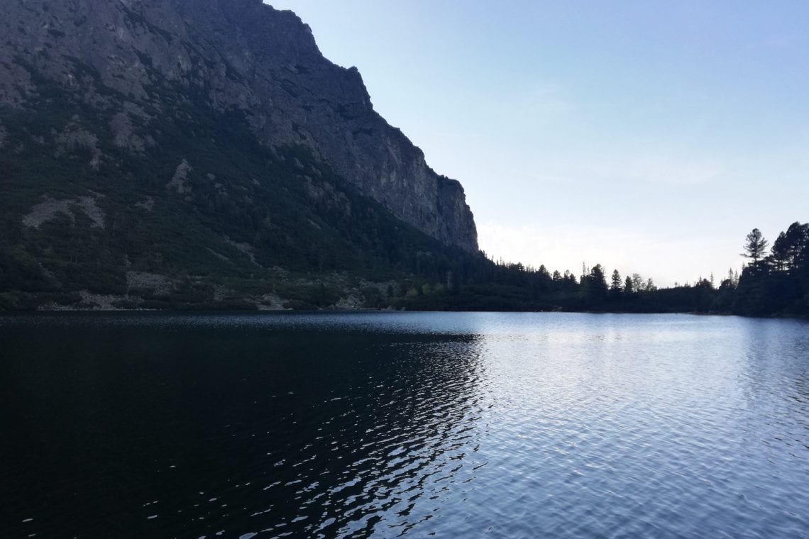
It’s perhaps about 25 minutes before the trail begins to level out, now it’s a bit muddy, I’m guessing it rained recently. The further we go the more stunning the vistas are. An hour in and we’ve reached the lake at Popradské Pleso; It’s a natural place to stop for a short rest. The still waters enclosed by steep mountain walls make for a picturesque scene, but we’re not alone. There is a hotel beside the lake, and there are a number of fellow hikers getting ready for their day out in these beautiful mountains. I think to myself how I’d love to stay in such a wonderfully located hotel and ponder what the no-doubt extortionate price would be for such a privilege.
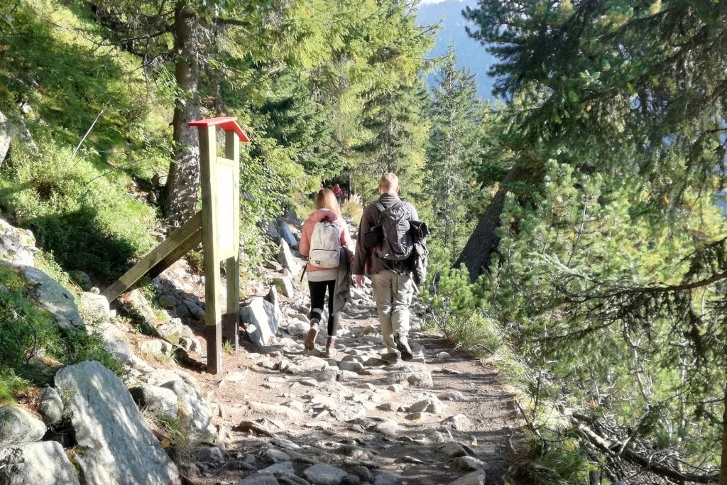
Above: The trail through the woods gradually elevates to reveal wonderful views
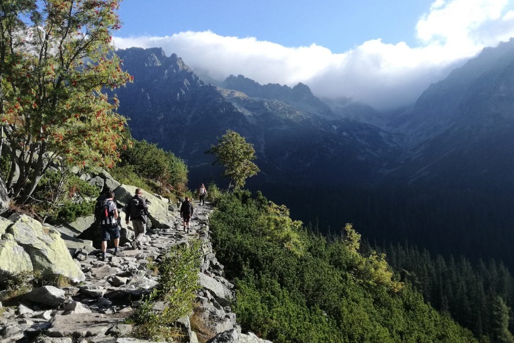
We’ve covered about 4km, but this is the easy part. From here it’s again up a steep rocky path. The sun is now higher in the sky and the temperature is defiantly increasing. It’s turning out to be a stunning day, albeit a hot one. By now the trees are not as tall as earlier, and just when I could do with some shade, the possibility of this seems unlikely.
Eventually we come across the dreaded steep switch backs but at least we’re now gaining some serious elevation. The views are spectacular, below the green valley, above the contrasting grey rocks. The trees are now far below us and the shrubs and wild flowers disappear, the route finally levels out over a boulder field where we pass another small and picturesque lake (Žabie plesá). Past the lake our route turns right and begins yet again to become steep, here we come across metal chains, ladders and platforms fixed into the mountain walls. Frustratingly, human traffic builds up here as people cautiously navigate the steep rocks, but there’s a sense of excitement and adventure as we traverse this section.
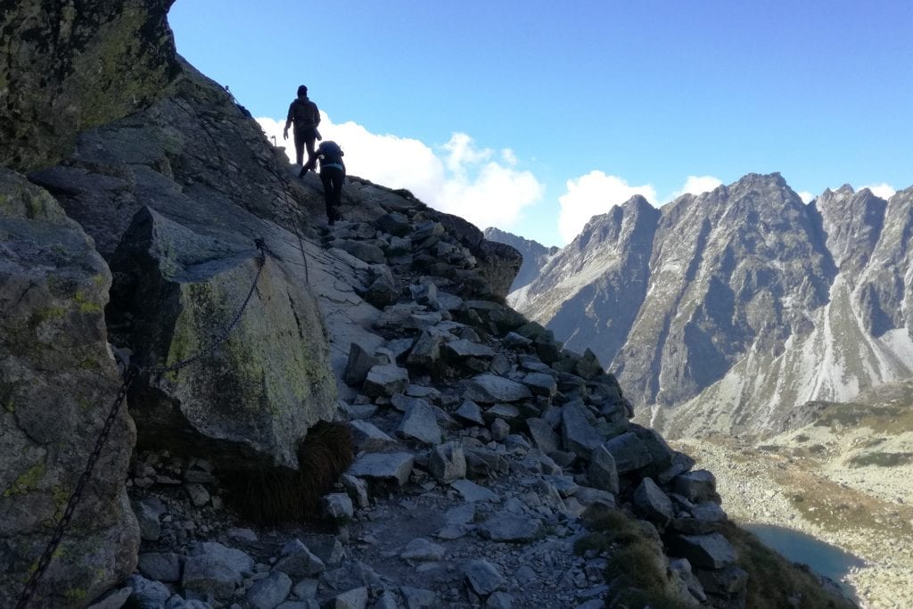
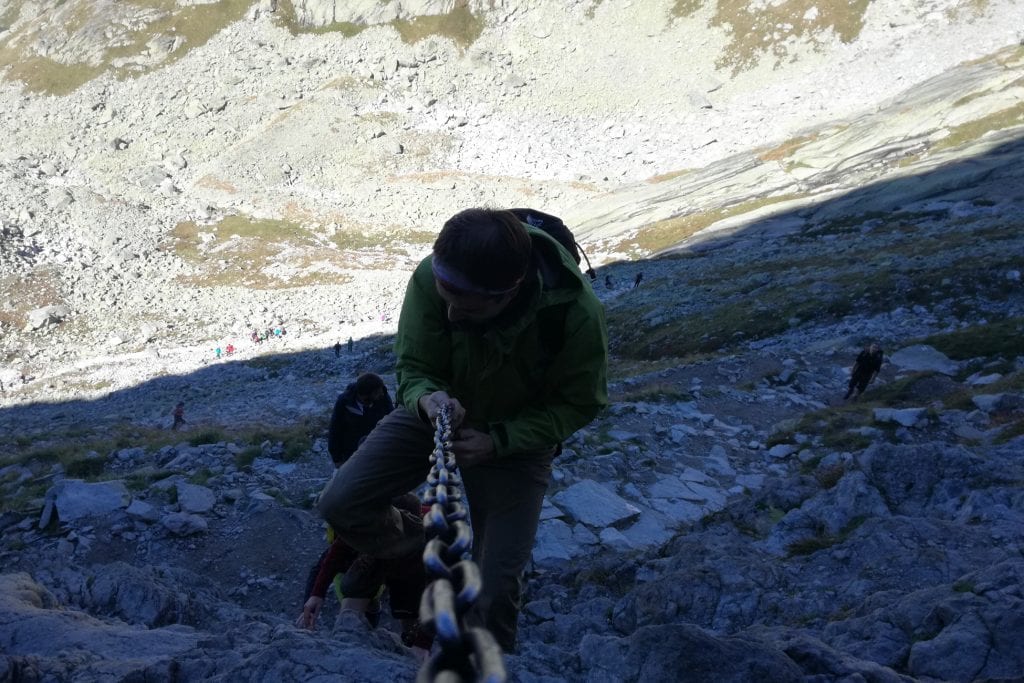
Above: If you take a bag of supplies up to the refuge you get a free cupper | Lake at Popradské Pleso | Hiker carrying supplies to the refuge | Lake Žabie plesá | Climbing up with metal chains
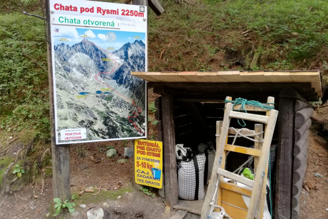
To my surprise I see a chap, not too far ahead of me carrying a keg of beer and some boxes on his back, which strikes me as absolutely insane until I deduce that he must be supplying the refuge below the peak, where we are heading; so I joking call to the others “follow that beer”. As we approach the refuge Chata pod Rysmi, which translates to Hut below Rysi, we pass an old Czechoslovakian bus stop complete with time table and bicycle. One can’t help but admire the sense of humor of whoever brought this up. The refuge has a lot of people around, some having their lunch, many queuing for the one and only outhouse, whilst others seem to milling about and taking pictures. At this point, patches of cloud have covered the sun, and I immediately notice the drop in temperature, but this is an ideal chance to go into the refuge for a rest, and warm up with a hot coffee. The hut is busy, and much to everyone’s bemusement someone here is playing a piano! How on earth did they get a piano up here?
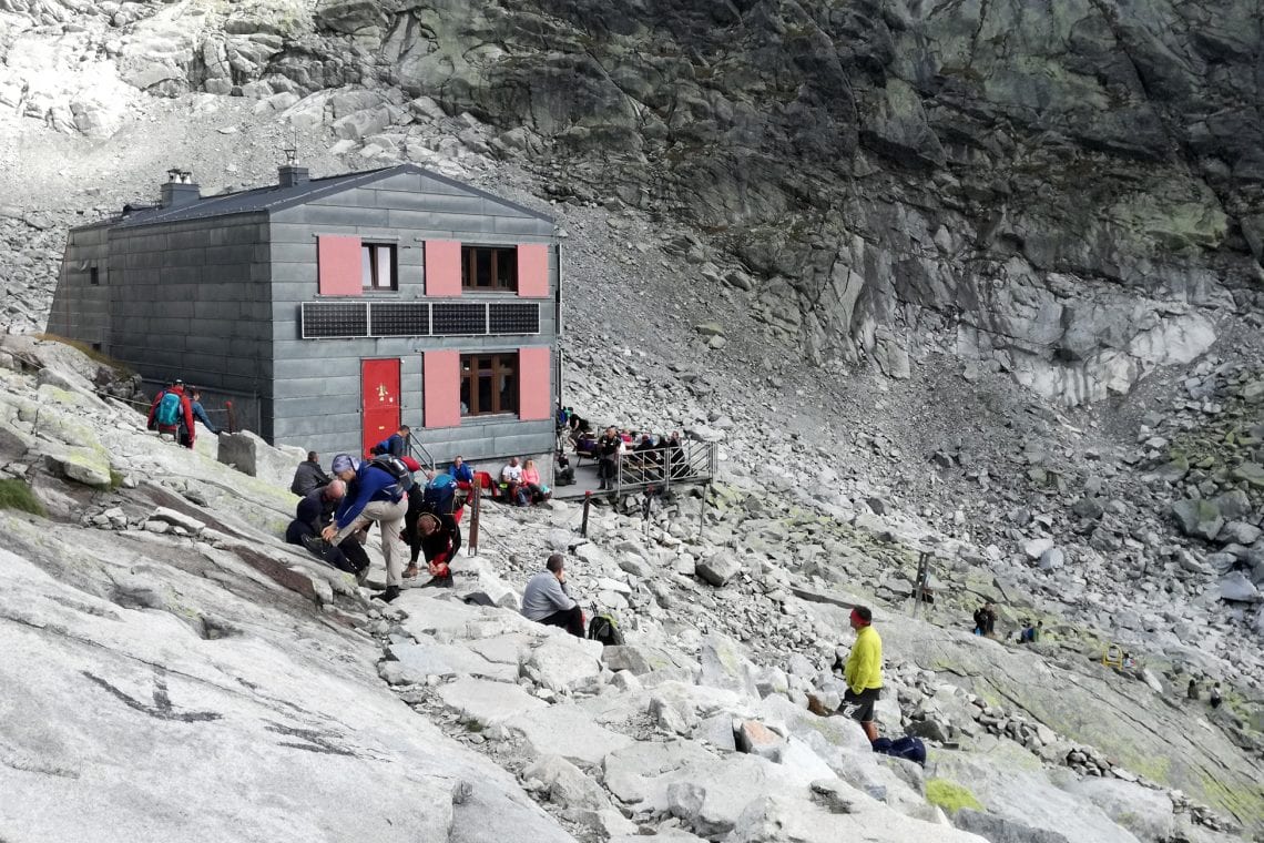
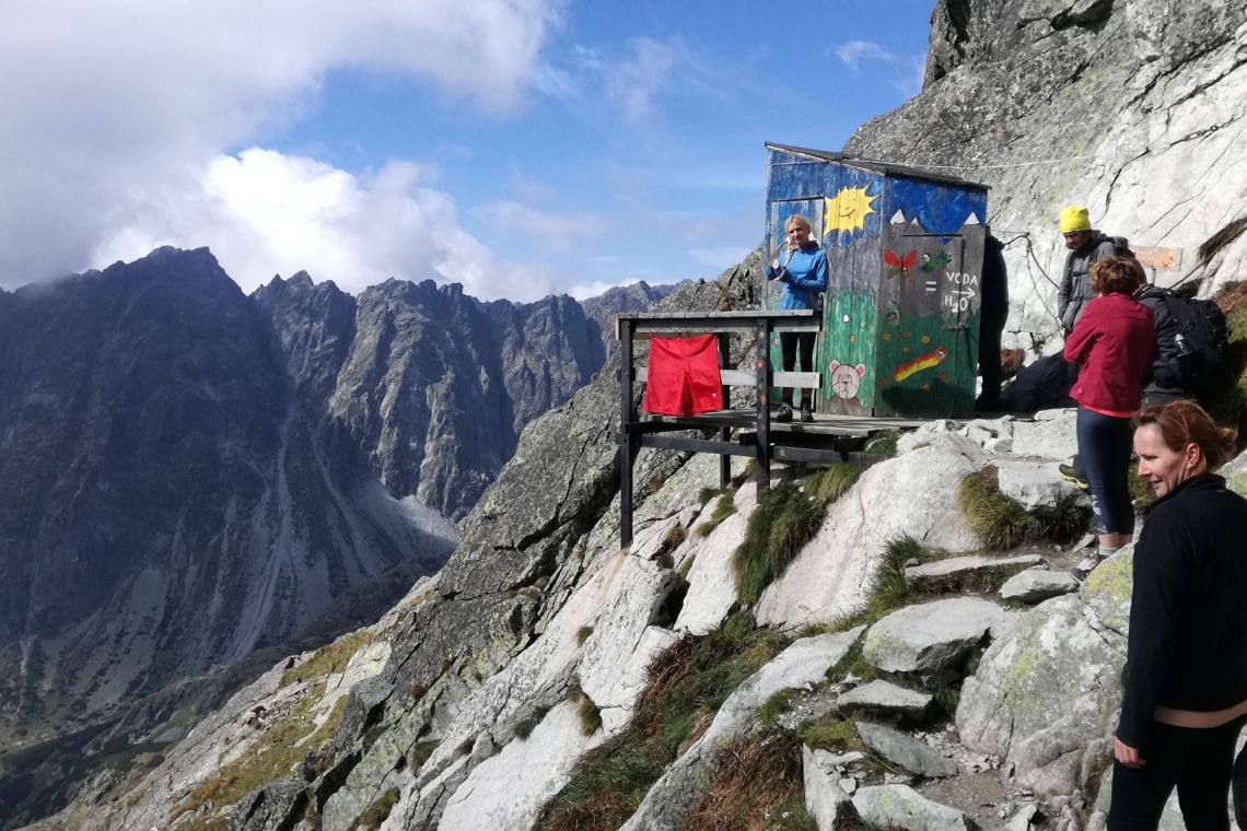
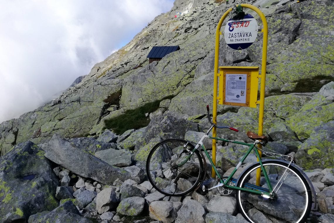
Above: Hiker carrying up a keg of beer to the refuge | The long drop | An old bus stop
Rather comfortable and settled it’s hard to tear ourselves from our chairs and leave the comfort of the refuge. We are told the summit is still about 45minutes away. Once again the hike takes us along a steep rocky path finally traversing a ridge, and for the first time we can actually see the peak. It still looks far, but I can make out the hordes of brightly coloured hiking jackets in the distance.
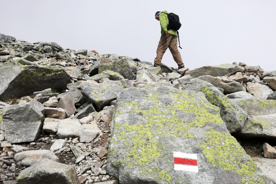
The route isn’t very well defined, but it appears to gradually decline before it heads back up to the peak. It has developed into a scramble, and hikers need to start using their hands on the final approach. It’s a slow pace but with the peak in sight I’m urged on, slowly and carefully until finally we reach the highest point in Poland!
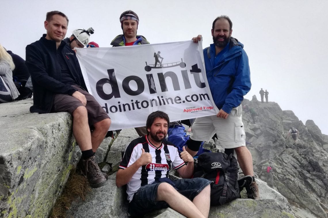
Above: Dan on the final and very steep section | We made it to the top of Poland via Slovakia
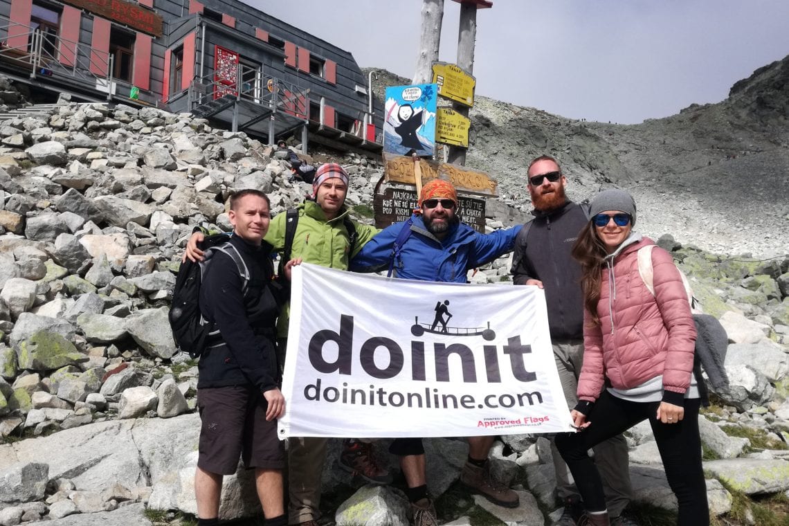
Unfortunately the weather’s turning and the cloud sweeps in impairing our views. The peak feels really crowded with people just sitting there, having their lunch and reflecting on their achievements. It’s a battle to fight our way to the trig point at the top. Once up there it’s not long before we get fed up with the crowds and we move a little further down where we congratulate ourselves on reaching the top.
It’s a little disappointing we aren’t treated to the view we were hoping for, but I still found this a rewarding hike. We’ve clocked almost 10km in about six hours, and all that’s left is to head back down along the same route we’ve come up! We’re only half way into our day I tell meself, which feels a rather daunting prospect.
The trek down is hard on the knees, and my body is chafing. It feels like forever as we retrace our steps back into town, reaching tarmac about 10 hours and 20km after we first departed just in time for a well-earned beer!
WHERE TO STAY
- There is plenty of options in the town of Štrbské Pleso
USEFUL LINKS
- Info on the High Tatar national park.
- Refuge below the peak of Rysy: Chata pod rysmi