Trip duration: 2 days | Approx cost: £100 inc share of petrol and accomodation | When: Weekender
Doinit factor: Reach the highest point of the UK!
‘The Ben’ as it’s so often called, holds the title as Britain’s highest mountain. Whist this might be the sole reason many flock to its peak (1344m), the natural beauty of the Scottish Highlands is reason enough to venture upon this stunning landscape. Close to the town of Fort William, the route starts not far of sea level meaning hikers ascend the full elevation on offer, no mean feat.
Due to its northern location within the UK, most visitors will need travel between Glasgow and Fort William via the A82. An enjoyable two hour drive on which the road snakes the Scottish Highlands, through valleys, around huge Lochs, past quaint villages and below towering cliff faces. The A82 route is essentially a whistle stop tour of a popular long distance trail, The West Highland Way, which takes eager hikers one week to make their way from Glasgow to Fort William under their own power.
Fort William has ample availability of accommodation. A simple web search will unveil a great choice of places you can put your head down, however, if reaching the summit is your goal then it’s best to make the ‘Ben Nevis Inn’ your base camp; a cheap basic bunkhouse with a charming pub situated above the sleeping quarters, located about five minutes from Fort William and right at the start of a track that leads up the mountain.
Don’t do this
Do not think it wise to finish work on a Friday, go home and try to fall asleep. You won’t. Then whatever you do don’t think it’s a good idea to leave London at midnight with the intention of avoiding all traffic and drive to Fort William overnight in one go. You’ll arrive at the foot at the mountain at around 7.30am. Then don’t decide to climb Ben Nevis without any sleep the night before. And finally – when you succeed on summiting the UK’s highest peak with no sleep the night before hand, don’t have that celebratory beer you deserve. Take it from me – this will ruin you.
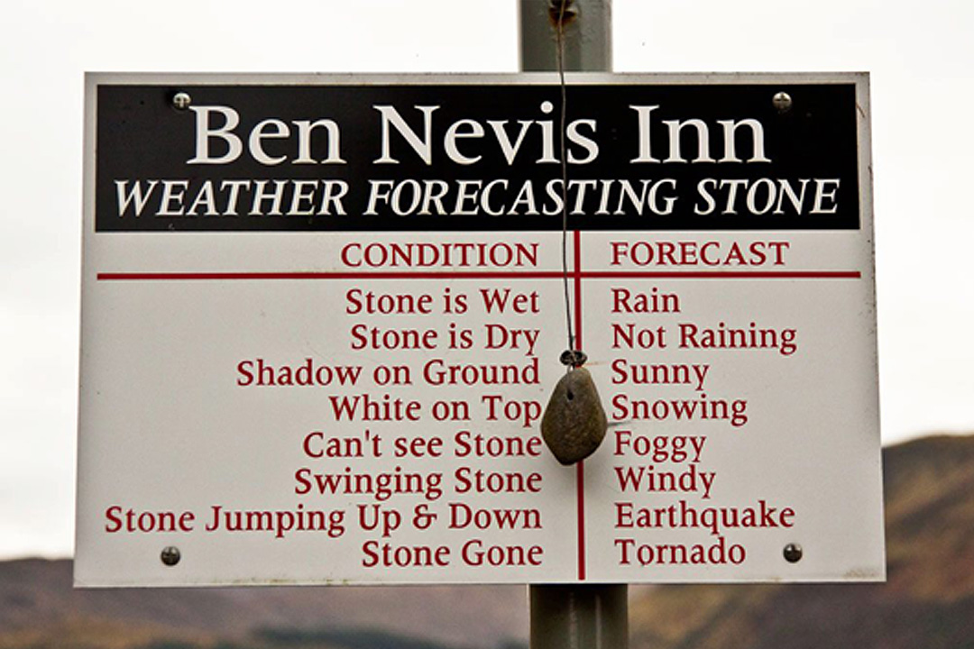
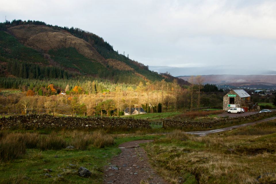
Above: How you tell the weather around these parts | The Ben Nevis Inn, our base
Here the ‘Pony Track’ also known as the ‘Tourist Track’ is where many adventurers start their day. The track is the most accessible way to the summit, though steep and strenuous in places, no technical climbing or scrambling is needed. It was originally used to supply an observatory at the summit and therefore the route had to be suitable for donkey’s that made the round trip. Some may find it disappointing that as the route hugs the mountain side, the peak remains invisible and thus you will have no sense of how long you have left to ‘climb’.
Making your way up the valley, you’ll become amazed at the speed the altitude increases over such a shallow gradient. The narrow muddy route saddles the valley side and takes visitors though ferns and shrubs, over bridges and the odd waterfall. Every so often it’s worth stopping to take in the view of Glen Nevis; you will be able to make out the small farm buildings dotted in the valley.
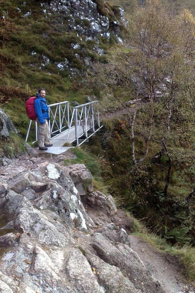
Above: Crossing a bridge and hiking along the side of the valley
A great place to have lunch arrives when you reach the first (and only) bench en route. Here it’s time to refuel as this is the point at which the climb evolves from a gentle climb into something much steeper. This is where the real work begins. The track starts to twist and turn, but in the grand scheme of things, bares left, hugging the slopes, and finally arrives at a grassy plateau. Here a pleasant and non-strenuous 500 metre walk will take you pass what’s often cited as the half-way point along Loch Meall; a small ribbon lake that makes a great reference point when ascending/descending. Temperatures here are significantly lower than at your start point, but that’s only to be expected at almost 600 metres high at this point.
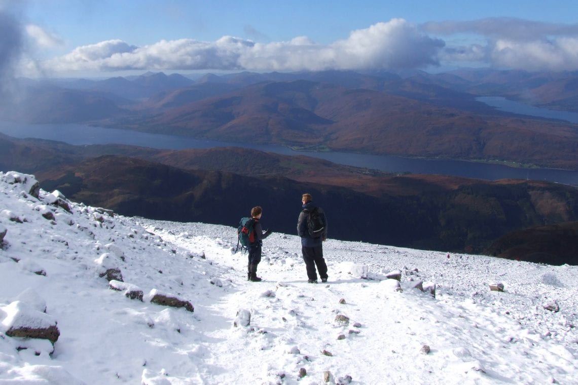
At the end of the plateau, the path forks. The ‘Pony Trek’ draws to the right. A more advanced climb will welcome you if you decide to turn left, however bare in mind this will not only add a further 2 hours to your climb, but it will also involve some scrambling. Further on, there is an option for rock climbing as well as abseiling. Choosing the ‘Pony Trek’ presents its own hazards and challenges. A full flowing waterfall may seem an ideal place to top up your water bottle, but be careful on the slippery surface; you have to bridge this yourself with wide strides. Once again, this landmark launches the climb into something steeper. The views here are amazing; you will see your route you’ve taken to get to this stage with a clear view of the ‘half way loch’, but more impressively the huge Loch Ele in the distance. This is the basin of water Fort William is situated on, but unfortunately the city remains hidden behind the Highland valleys. Even further in the distance, the sun illuminates the Scottish Highlands, making a picturesque panorama of clouds gently rolling over the many peaks and ridges.
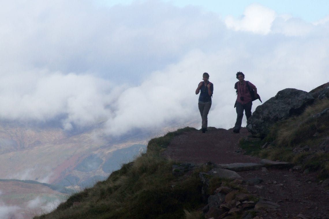
Above: Past half way and the scenery is absolutely beautiful
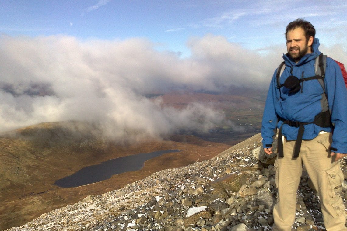
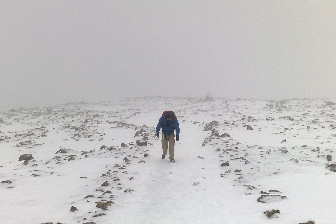
Vegetation becomes scarce and soon all together disappears. The green slopes turn to grey scree and the atmosphere changes. The sudden steepness ensures altitude rises quicker than latitude and the temperature drops another level as you enter the clouds. This can be a real challenging section of the accent for many people. Visibility reduced to no more than a couple of yards, no clear finishing line in sight, and the wind chill adds to the mental challenge. Perhaps the best way to conquer your apprehensions is to set short goals. Pick a larger boulder out in the distance and make your way towards it. Once achieved, have a breather, pick out a new target and set off. You will soon be amazed how far you can get.
Above: We’ve reached the snowline
The never-ending ‘zig-zags’ will finally give way to the final push to the summit. The path once again becomes more defined and cairns begin to mark the way. In foggy weather, these cairns are the only markers you will see and should be portrayed as your best friend; not only giving you a sense of direction, but they also steer you away from the sudden edge of ‘The North Face’. The popularity of this mountain means that if you become disorientated, a simple attention to noise and people’s voices should guide you back in the correct direction.
Following the cairns, a new plateau emerges. The rocky horizon gives way to structures in the distance and the ruins of the old observatory are revealed. Much to the amazement, this is not the only structure visible. The summit is also home to a refuge to anyone caught out in exceptionally bad weather as well as Britain’s highest man made memorial; a wall to those who perished in World War II. A humble silence falls around.
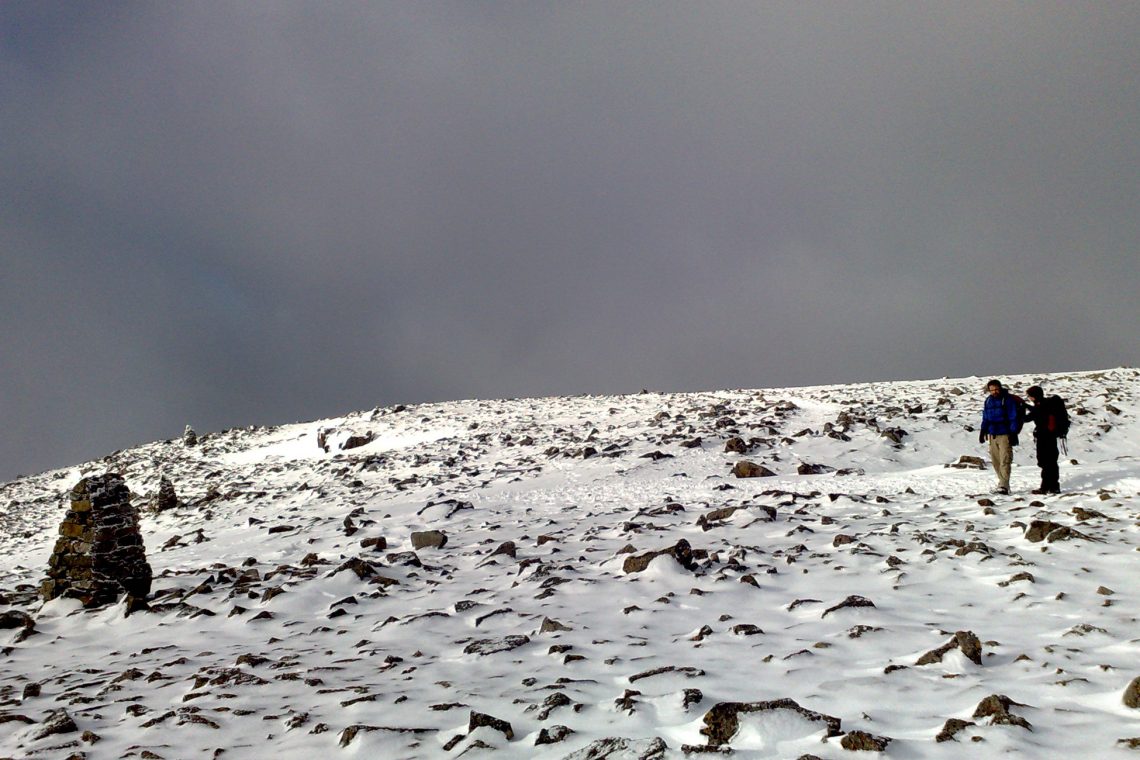
Above: It’s cold and the weathers starting to turn near the top
Only a few metres away is the official ordinance survey trig point positioned on top of a large solid cairn. This officially marks the highest point of this great island! Apart from a hand full of scree, the only souvenir cries out in the form of a picture and the sense of achievement. Everything that you have worked so hard to achieve in the past couple of hours, is undone by a brisk 2 hour hike back down.
It goes without saying that as the UKs highest point has some amazing views. Neighbouring valleys and mountains can be seen for miles with lochs nestled in-between them. The weather will dictate what you will be able to see. On a very clear day you see the Western Isles on the horizon as well as much of the Northern part of Scotland. In contrast, on a partially cloudy day you may be in for a treat to, as low lying clouds flow around peaks, covering the lands below. The sunrays reflect off the Highlands and huge shadows are cast on the adjacent landscape. Both spectacular and magical. If it weren’t for the winds and temperatures you could sit here for hours simply gazing down upon the world below.
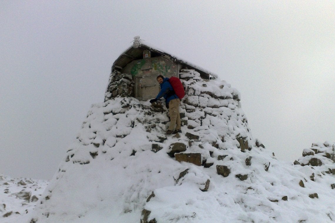
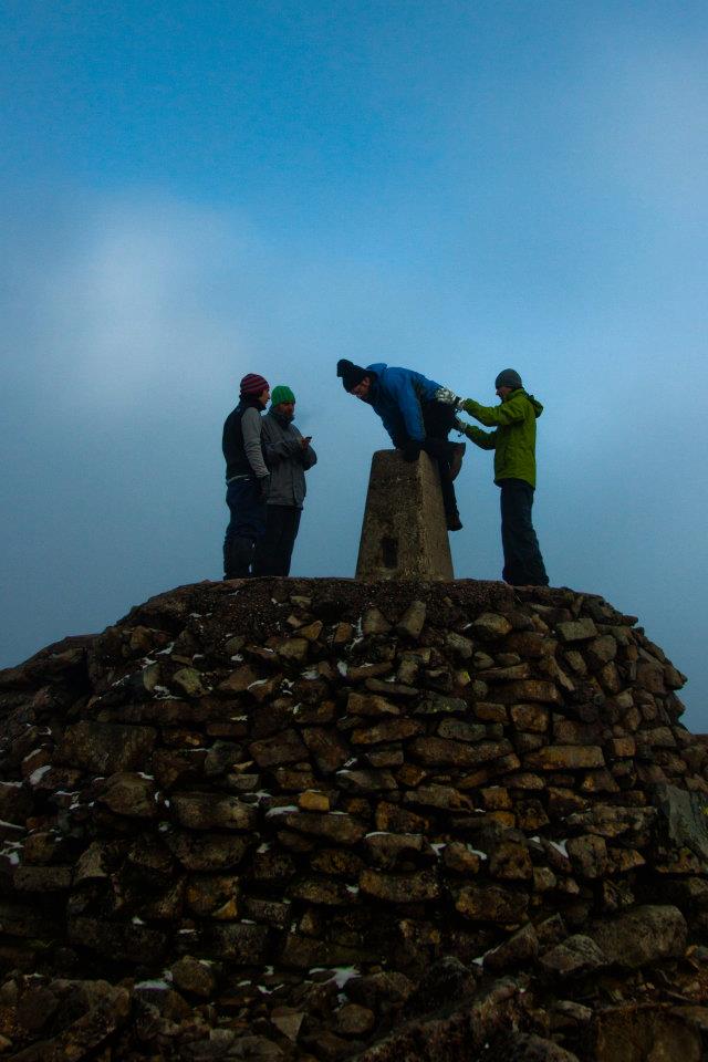
Above: Taking a closer look at the shelter before climbing on top of the trig point to be the highest person in the UK
When a decision to make your way back down the mountains comes, it should be via the same route. While this can takes its toll on knees, the decent can take half the time it took taken for you to reach the principal peak. A usual hint if undertaking this adventure on in late autumn is, leave yourself with enough time to descend in daylight. You will not want to be left in twilight or worse! As you make your way down, the Ben Nevis Inn is almost a welcome sight as the summit was a few hours earlier. Here you can put your feet up and have that pint that you’ve so rightly earned.
WHERE TO STAY
- We stay Ben Nevis Inn and Bunkhouse just by the trail head. There are a lot of other options in Fort William.
USEFUL LINKS
- Visit Fort William
- Summit post: Ben Nevis