Trip duration: 2 days | Approx cost: £180 inc flights, care hire and accom | When: Summer
Doinit factor: Spectacular views as you hike over an engineering marvel!
It’s a late evening and the TV is on in the background, mostly serving as background noise; at least up until ‘Abandoned Engineering’ peaks my interest. The show starts with a typical narrator enthusiastically introducing The 52 Tunnel Road. I’ve never heard of if but with a name like that, and after watching a couple of minutes of dramatic footage, I’m hooked. It’s not long before I’m online trying to work out how I can explore this for myself.
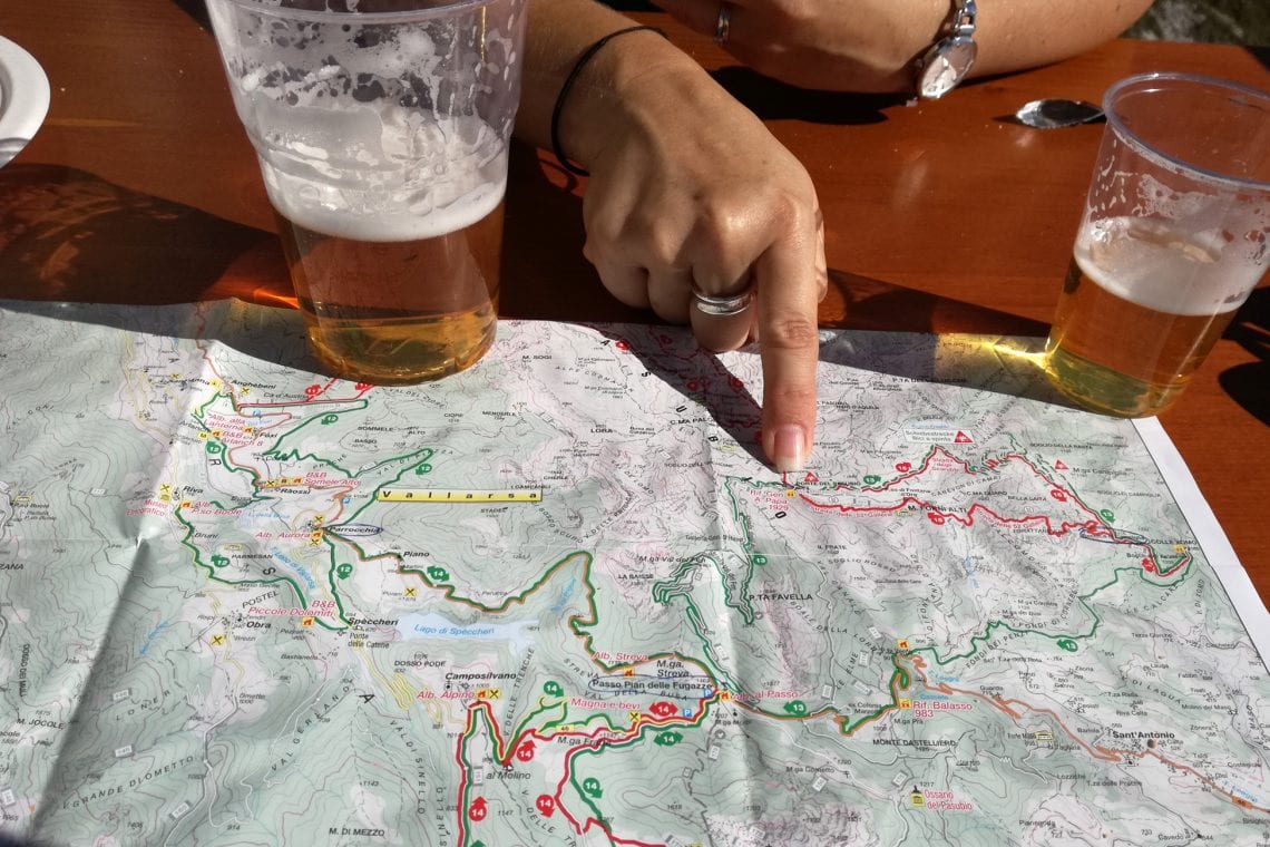
It’s a Friday and I’ve just finished work as I head to the airport for my quick weekend adventure. It’s a two hour flight from London to Verona, where I’ve a hire car waiting. Then it’s an hour’s drive along the motorway until the city of Revereto from which it’s a further 20 minutes along a narrow windy mountain road to our base for the weekend, the village of Parrocchia. We arrive just before midnight, and most importantly in time for last orders at the hotel bar. That night we tell our hosts of our plan to walk the ‘Strada delle 52 Galleria’ so they offer to drop us off at the trail head. This is actually really helpful since the Strada is a linear route with most visitors walking it from the trail head at Bocchetta Campiglia and then back again. However, for us, the plan is to walk back another way, via the Strada degli Eroi. This will take us down to a main road where our hosts agree they’d pick us up about six hours later.
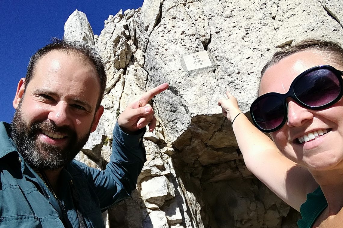
It’s 10am and we’re at the trail head, ready for our walk. The area seems pretty busy with hikers getting ready for their day, tightening their straps, putting on sunscreen, and most annoyingly, taking pictures of the memorial wall and getting in the way of me trying to do precisely that! It’s a futile effort, so instead I walk up to the memorial and read about the history of the 52 Tunnel Road.
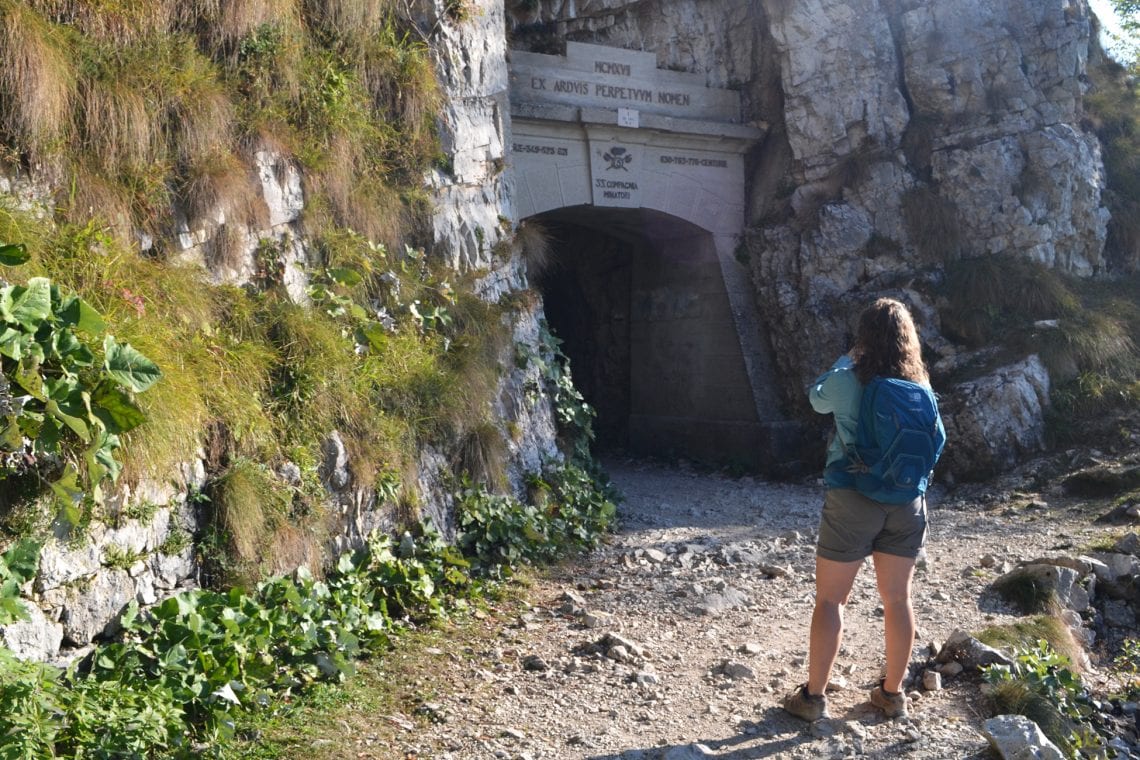
Above: The trail head is part memorial and information board | Approaching the first tunnel
The road was a military mule road built during the First World War (1917) by Army engineers, the 33rd Miners Company of the Italian Army, with the help of about 600 men. The road runs at an elevation between 1,216 and 2,000 meters, and as the name suggests, consist of 52 tunnels carved into the rock where sculpting a path along the sheer cliff face was not an option. With work commencing in February and completion in November, this six kilometres long road carved into the southern slop of Mt Pasubio was built within nine months! A feat of monumental proportion; especially considering the road works outside my house have barely moved within the last three months.
The enemy was the Astro-Hungarian Empire and they were closing in, already capturing nearby peaks, and setting their sights on an invasion of Venice. The Italians had to stop the enemy’s advance so the road was constructed to transport vast numbers of men and equipment to the front lines. The men who built this road were up against tremendous odds, the terrain, the freezing weather conditions, and the pressure of an enemy closing in; topped off by it all being built by hand using jack hammers and dynamite.
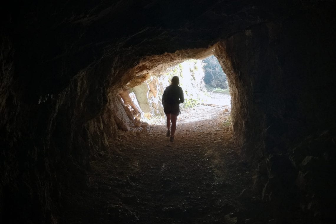
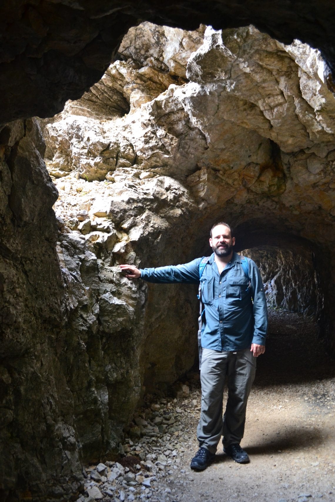
Armed with a fraction of the historical knowledge associated with the road it’s time to see it for myself. The gravel path twists back up on itself through the woods, but it’s not long before we reach the first tunnel. Reinforced with concreate and an engraving to commemorate the men who built this it marks the start of our journey along the 52 Tunnel Road.
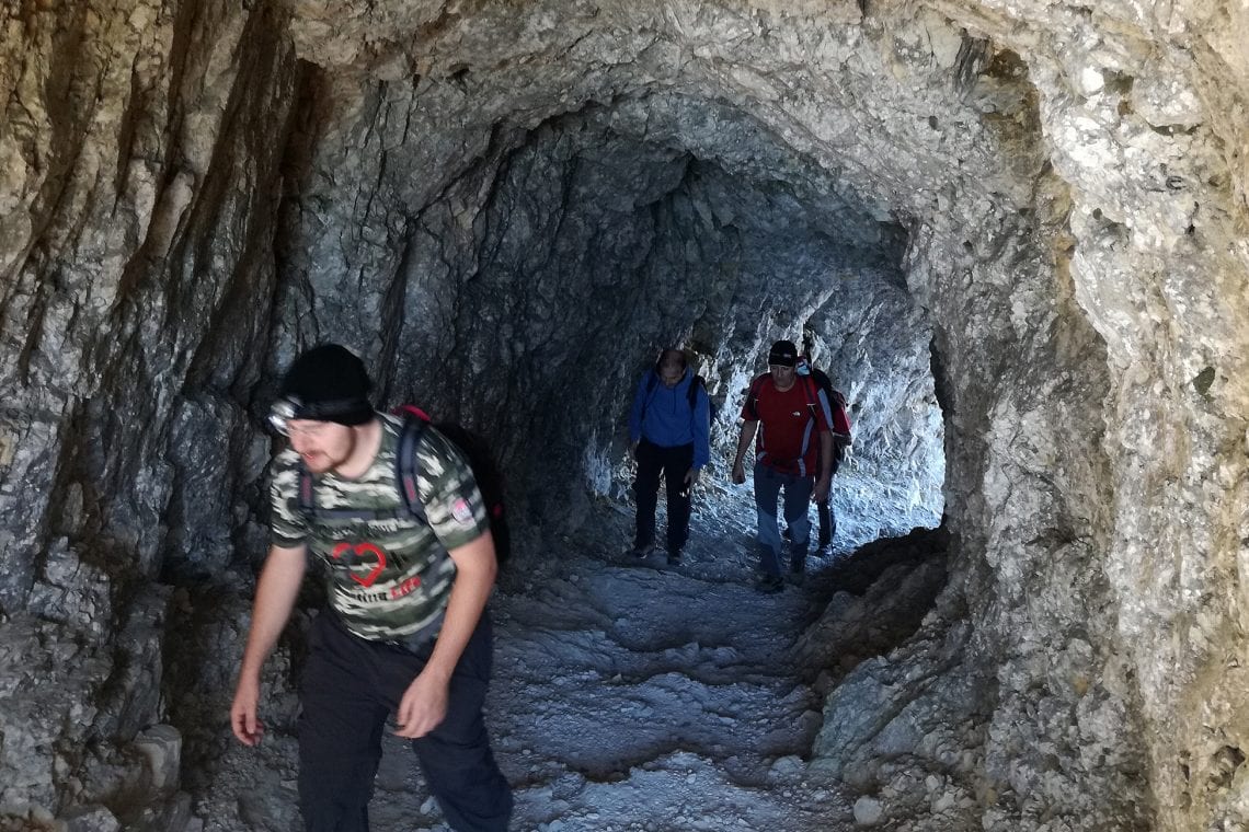
Above: Tunnels and cliff paths with amazing scenery
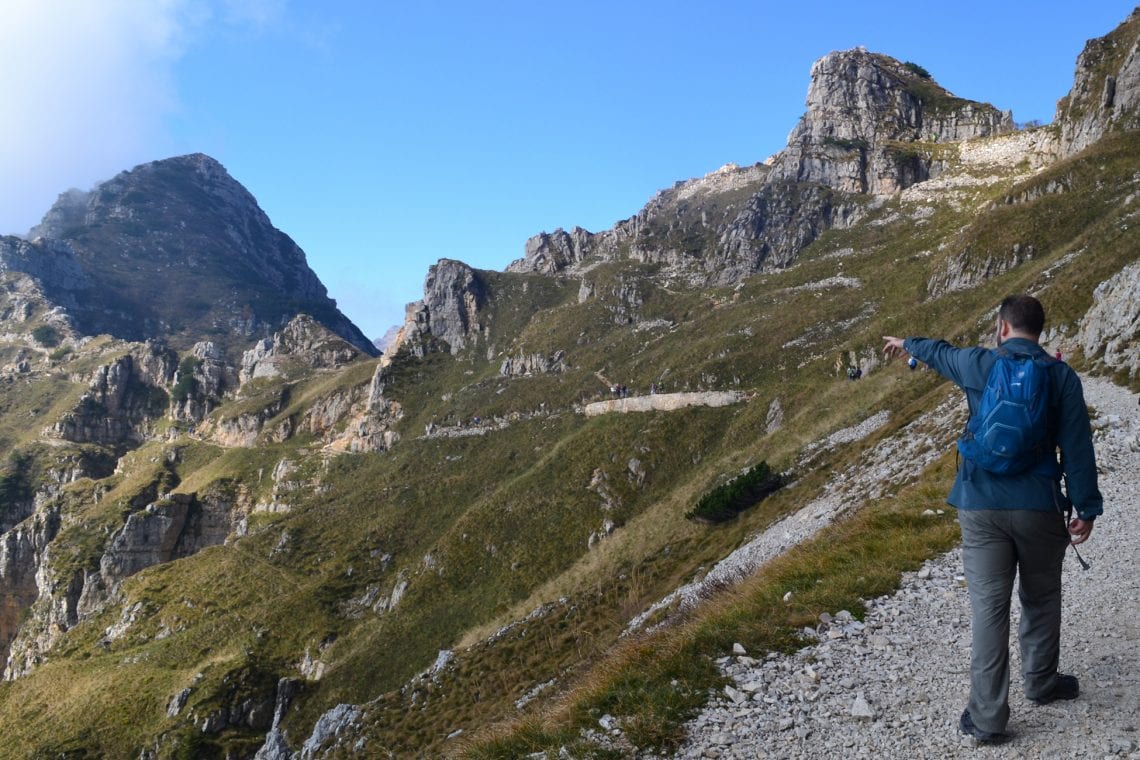
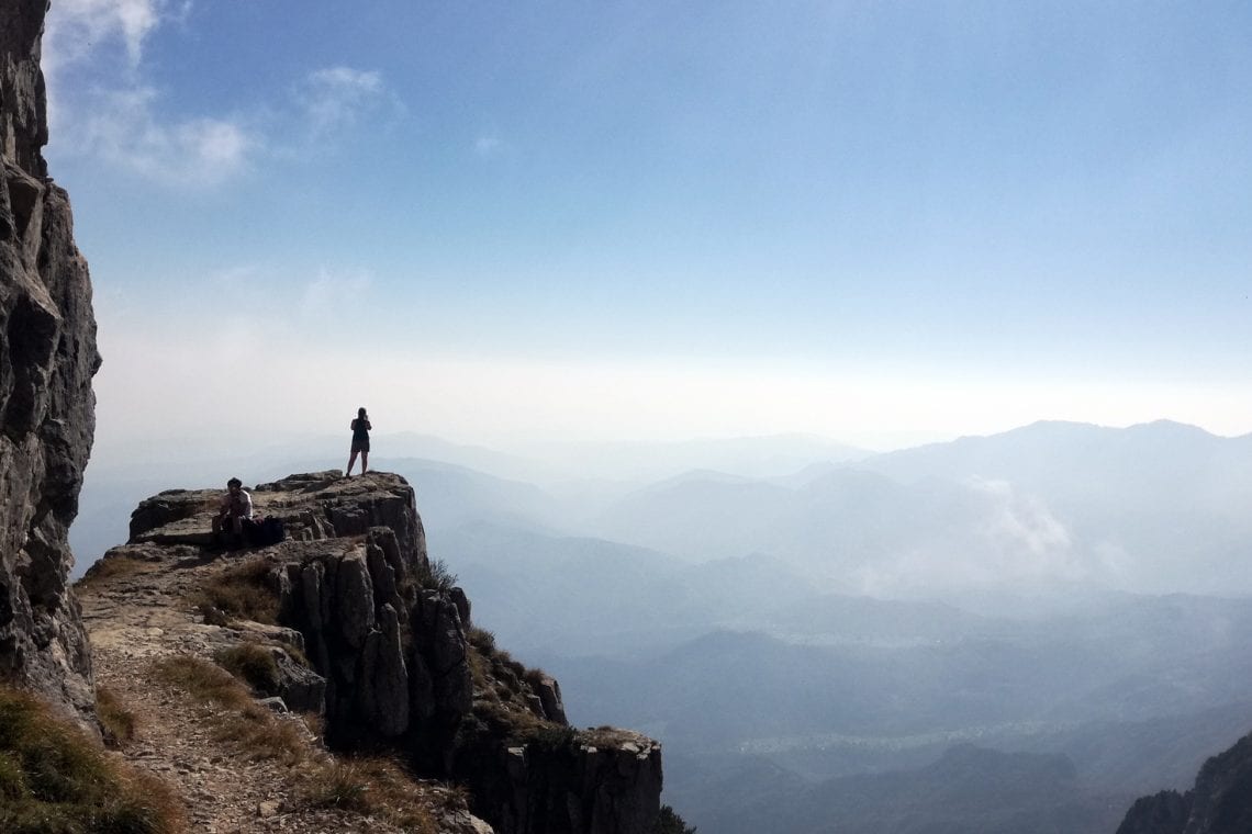
With each step we take, the darker it gets and soon it’s pretty much pitch black. I’m glad we brought torches, pity I didn’t check to see if the batteries were charged. Fortunately the torch function on our phones is enough to guide us to the end of the first tunnel. Over the course of the next few hours, tunnel after tunnel, we navigate our way through the twisting darkness. Whilst walking we had no idea how long or how steep the incline was in some of the tunnels; the longest being 318 meters (tunnel 19). When crossing the non-tunnel sections, the path is carved into the rock with a shear drop to one side and views of the surrounding landscape stretching for miles. The contrast of hovering over cliffs to being in them provides a sense of excitement; you don’t really know where you’ll be, or what you’ll be seeing a few minutes ahead. The tunnels also provide relief from the heat of the day, but just about as I start to feel too cool, the tunnel ends allowing me to warm up once again.
Each tunnel has a marker on the trail along with a name, and many of them have an information plague relating to the construction of the particular section of the road. Of particular note is tunnel 20; here to overcome a significant height difference the tunnel corkscrews around on itself, and leaves you quite disoriented. The highest part of the road is just after tunnel 47 where we’re at 2,000 meters. Here just a few feet off the main road, is a ledge ideally placed to take a break while admiring the spectacular panorama.
Above: Tunnel 20 is actully a corkscrew | As with most of the route, there are amazing vistas
We finally reach tunnel 52 and the end of the road. Here the impressive Rifugio Gen. Achille Papa comes in to sight. It’s a large white and yellow building, and it looks like there are 100’s of people sitting outside on the terrace, having their lunch and basking in the sun. Up until now our day has been spent in relative solitude and I initially I wondered where all these people have come from as we’ve not seen too many over the last few hours, but I soon realise the refuge is at a confluence of a number of hiking and mountain biking routes.
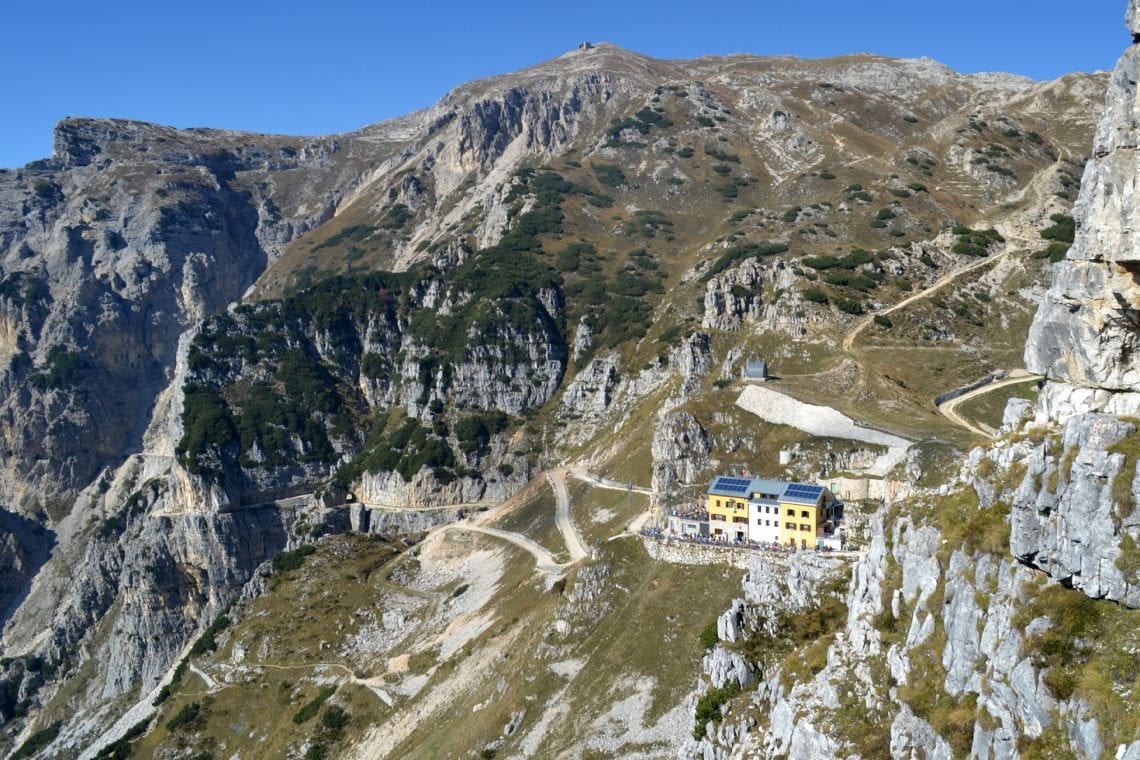
Above: We’ve reached Tunnel 52 and now head to the refuge
It’s lunch time so time for a sandwich and a beer. With the lovely weather, fantastic scenery and a cold beer it’s easy to forget we still have about a three hour hike ahead, so after an hour it’s time to move on. There’s a large number of mountain bikers here, though the Strata 52 is definitely off limits to bikes, there are other routes in the vicinity which are consider safe to ride. It is one of these which we’re following for our decent back; La Strada degli Eroi which translates “to road of heroes”. This is a wider loose gravel road built in 1922 to enable vehicular access. The views remain spectacular as it gently winds down to the valleys below. It snakes and bends back on itself being easy on ones knees, though you do need to be aware of cyclists zooming down past you. There is a steeper hiking route, the E3 which intersects the road at each level and makes for a more direct route down, but thick vegetation suggests it’s probably less popular than the gentler road. It’s a little under three hours and we’ve reached the end of our hike, a small car park at Pian Delle Fugazze.
It’s been an absolute honour to follow along these steps of history. What was achieved here over 100 years ago is truly amazing, and I’m glad that while the war is long over, people like myself now have the opportunity to walk one of the greatest hiking trails in Europe. All that remains is to call our hotel and shout taxi taxi as loudly as I can into my phone in the hope that they understand a lone English couple are in a carpark in the middle of nowhere ready to be collected.
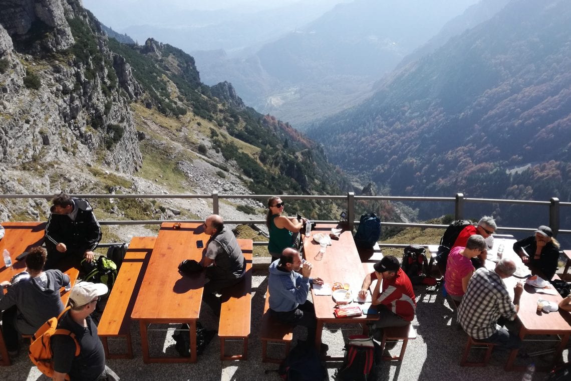
Above: The refuge stands probably amidst the mountains | Time for a well earned beer
WHERE TO STAY
- We stayed the lovely Hotel Aurora in the commune of Vallarsa
USEFUL LINKS
- Website of the Strada delle 52 Gallerie
- Website of the Trentino region