Trip duration: 2 days | Approx cost: £160 inc flights, care hire and accommodation | When: Weekender
Doinit factor: When you’ve done the big three, and you want to bag another peak!
While the three peak challenge makes for popular discussion amongst British hikers, often forgotten is that in fact there is a fourth peak. At 850 meters Slieve Donard marks the highest point of Northern Ireland, and although Ben Nevis, Snowdon and Scarfell Pike get all the attention, we head over Irish Sea to acquaint ourselves with this often overlooked mountain.
The trail head begins at the free carpark at Dionard Park in the pleasant seaside town of Newcastle (Co Down). It’s 1pm by the time we set off having flown in from London that morning. The weather is looking pretty grey, but it’s not raining yet and with that in mind we’re eager to cover some distance before the weather inevitably worsens. The first part of the trail takes us through a lovely enchanting woodland; the leaves on the trees and surrounding vegetation is a lush green, the smell of damp forest draws us in further, and twisted roots keep us alert as we gradually climb in elevation.
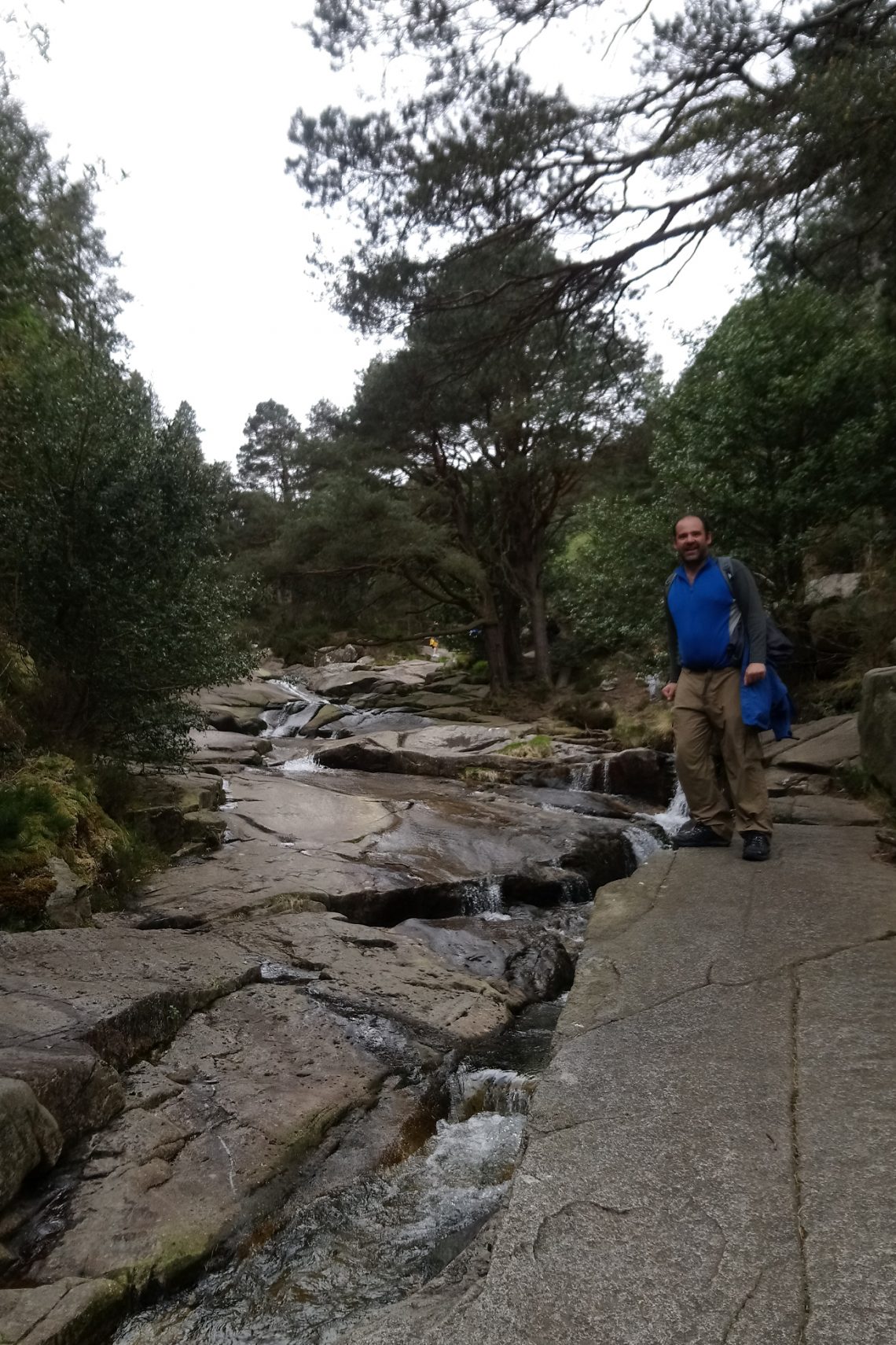
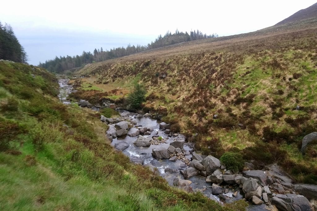
Above: We set off in the woods and follow the stream uphill
We follow the sound of the rushing Glen River which has carved a deep riverbed below; being cautious not to get too close to the overhangs, as several signs warn, we continue uphill. Of course, for those craving a bit more adventure, it’s possible to walk over the rocks and boulder your way up the river. The journey continues through the woods and over a couple of bridges before we head along the side of the valley where a rough and rocky path heads toward the mountains. Now, only woods to our right remain and for the first time we see up the valley. It’s also worth remembering to occasionally look back, it’s been a relative short distance, perhaps about a mile, and we can see how much height we’ve gained. In the distance we can see parts of Newcastle, its beach and the calm Irish Sea.
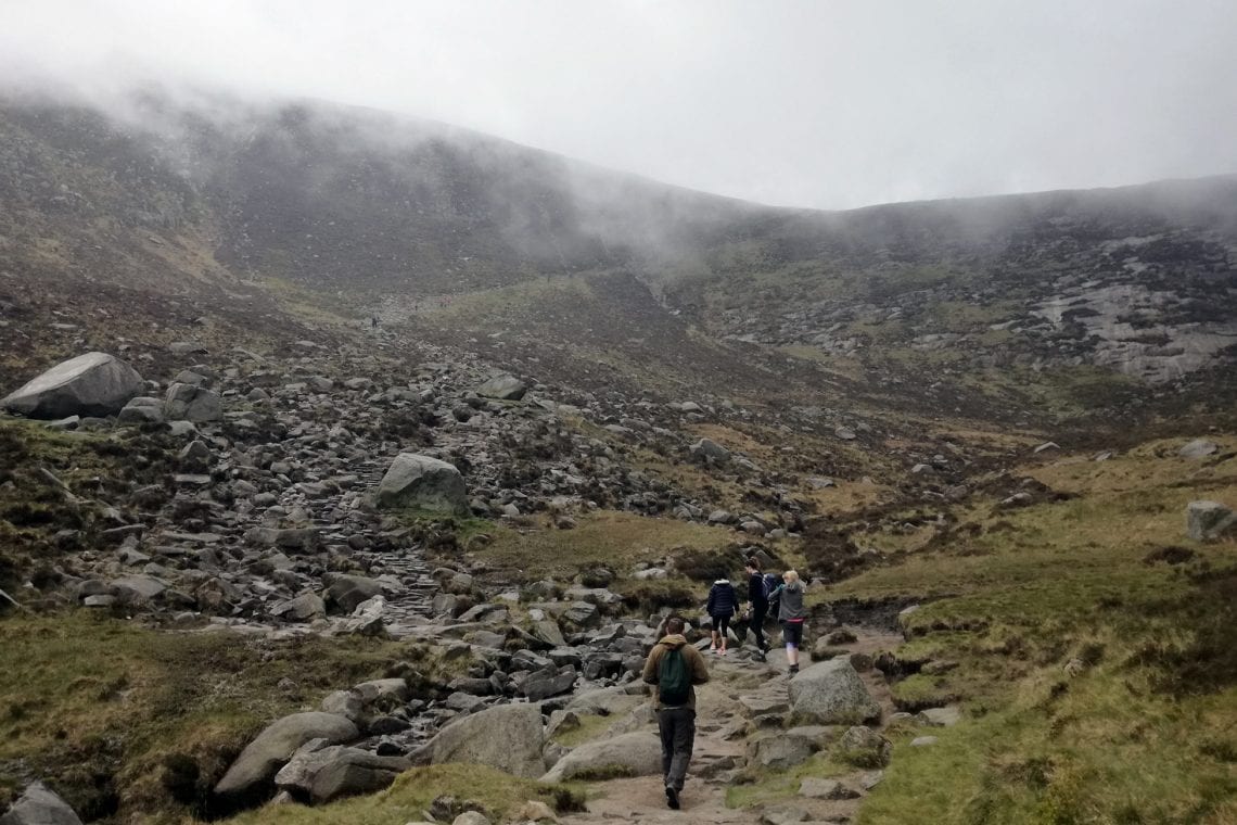
Above: Emma woriking her way up | Danny just about head up the stairs | Dave cought in fog
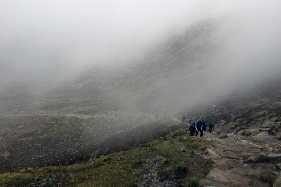
As the forest abruptly ends we can see the trail far ahead as it climbs steeply dotted with brightly clothed hikers far ahead of us. It’s approximately a further 2 km when our rocky path crosses the shallow river and begins to heads towards the dauntingly steep steps running up the valley to the saddle, between the peaks of Donard and Commedagh. Whilst the route has pretty much been constantly uphill, these steps constitute a significant increase in gradient and as we continue to gain elevation it’s not long before we’re engulfed in mist. Surprisingly, the steps are conquered in a relatively short space of time before we finally reach the top of the saddle. We’re now exposed to the elements – the elements mostly being really fine, very cold drizzle blowing sideways.
Above: Emma woriking her way up | Danny just about head up the stairs | Dave cought in fog
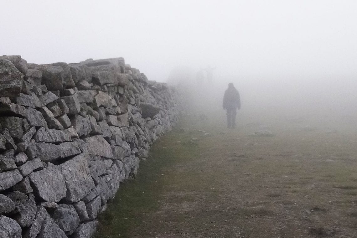
A dry wall crafted from granite (The Mourne Wall built between 1904 and 1922) runs along the saddle linking the three highest peaks in the area; fortunately, this provides some much need protection from the oncoming winds. We climb over the wall using a stile and turn left to tackle the final approach to the summit.
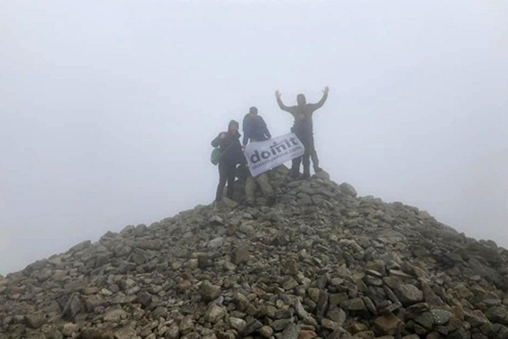
It’s steep, relentlessly so; it’s also highly eroded making it difficult to walk. Not helped by the deteriorating weather conditions, progress is slow and we’re all struggling. Instead of directly heading for the summit it’s easier to zigzag up hill, even so our legs are getting a proper workout with fairly big steps required. Frustratingly low visibility means every so often we come up to a false peak. I want this to end. I’ve had enough when finally a summit structure becomes visible; but is this just another trick? Fortunately not. This last section is grueling, and I think to my-self how naive I was to believe that the lowest of the UK’s highest peaks would be any less of challenge. Starting from sea-level, we’ve fought for every one of the 850 meters to reach to the top and the sign of relief is obvious as we take cover behind the wall to have our packed lunch. I check the time and am surprised its only taken two hours to reach the summit, but its certainly not been an easy two hours. After a quick lunch we climb over a final stile and up a mound of rock, the true highest point on Slieve Donnard. It’s a shame we won’t see any magnificent scenery today, and after about 25 minutes at the top its time to head back along the same route we came, oh our poor knees.
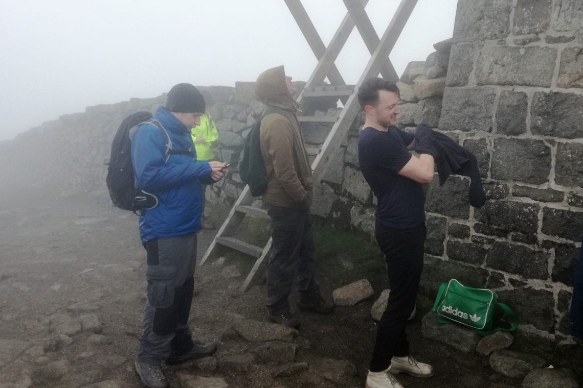
Above: Emma woriking her way up | Danny just about head up the stairs | Dave cought in fog
Giants Causeway
Not practically close by, but a must visit when you’re in Northern Ireland, is the Giants Causeway. Approximately a two-hour drive from Slieve Donard to the opposite end of the country is the UNESCO world heritage site of the world famous interlocking basalt columns. Whilst this is a tourist trap and cash cow for the National Trust it’s well worth a visit. It’s worth noting that whilst much of the signage appears indicate a visitor needs to pay to visit, this is not accurate. Access to the Giants Causeway is actually free – simply walk around the visitor center as this is a public access path.
WHERE TO STAY
- We stayed at: The Mourne Lodge Cnocnafeola
USEFUL LINKS
- Summit post: Slieve Donard
- National Trust: Giants Causeway