Trip duration: 3 days | Approx cost: £400 | When: May – Sep
Doinit factor: Outstanding natural beauty canyons and some pretty good cider!
Up until very recently it was unbeknown to me that Northern Spain is home to a spectacular mountain range, The Picos de Europa, or the Peaks of Europe. What have I been missing? The range is largely made up of limestone stretching for about 20km with the highest peak being Torre Cerredo (2650m) all within a national park of the same name.
It’s no more than a two hour flight from London to Santander, then with a hire car it’s another hour and twenty minutes before we arrive at our destination, the town of Las Arenas. It’s the perfect base for anyone wanting to explore the Picos. The town of about 800 inhabitants is only a few kilometres (15 minute) drive from the National Park, and the starting point for a number of trails.
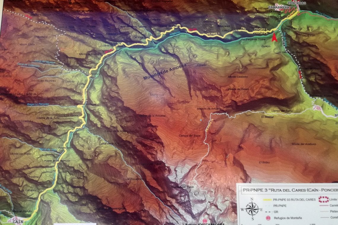
We’ve arrived by night so it’s not until the next morning the picturesque scene is appreciated and surrounding mountains are revealed. The park has trails which cater for all abilities but we are here to walk the most popular, and some say the most spectacular and breath-taking in all of Spain. The Cares Trail (Ruta del Cares) which takes its name from the river which it follows is approximately 11km long and connects the two settlements of Poncebos and Cains. The trail mostly takes the form of an impressive sculpted pathway along the deep limestone gorge wall.
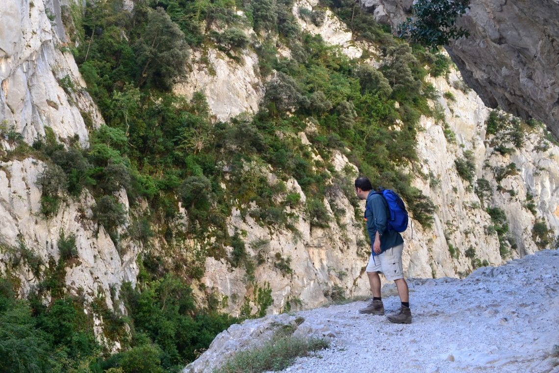
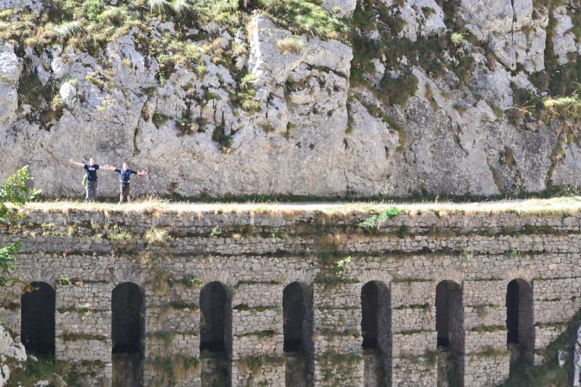
Above: Straight from the start the views are dramatic
We arrive at the trail head, a little later then I’d hoped and there are already a large number of cars parked along the narrow road. The trail starts off steeply. It’s up hill and over a well over trodden rocky path for about 45 minutes and we gain elevation rather quickly. This is the wider part of the gorge so it’s largely exposed with little to no shelter from the sun. It being late September I did not expect the temperature to be as high as it is. I’m already drenched in sweat and its dawning on me that I’ve definitely over packed; gloves, winter coat, what was I thinking?
As we reach the crest of the initial section of the trail our intended route reveals itself. For what seems like miles it runs into and an ever narrowing gorge, its grey rock walls closing in. Specs of colour dotted along the trail being that of fellow hikers sporting their brightest outdoor kit. I really wanted to have this all to myself but I completely understand why so many people are here, it really is impressive.
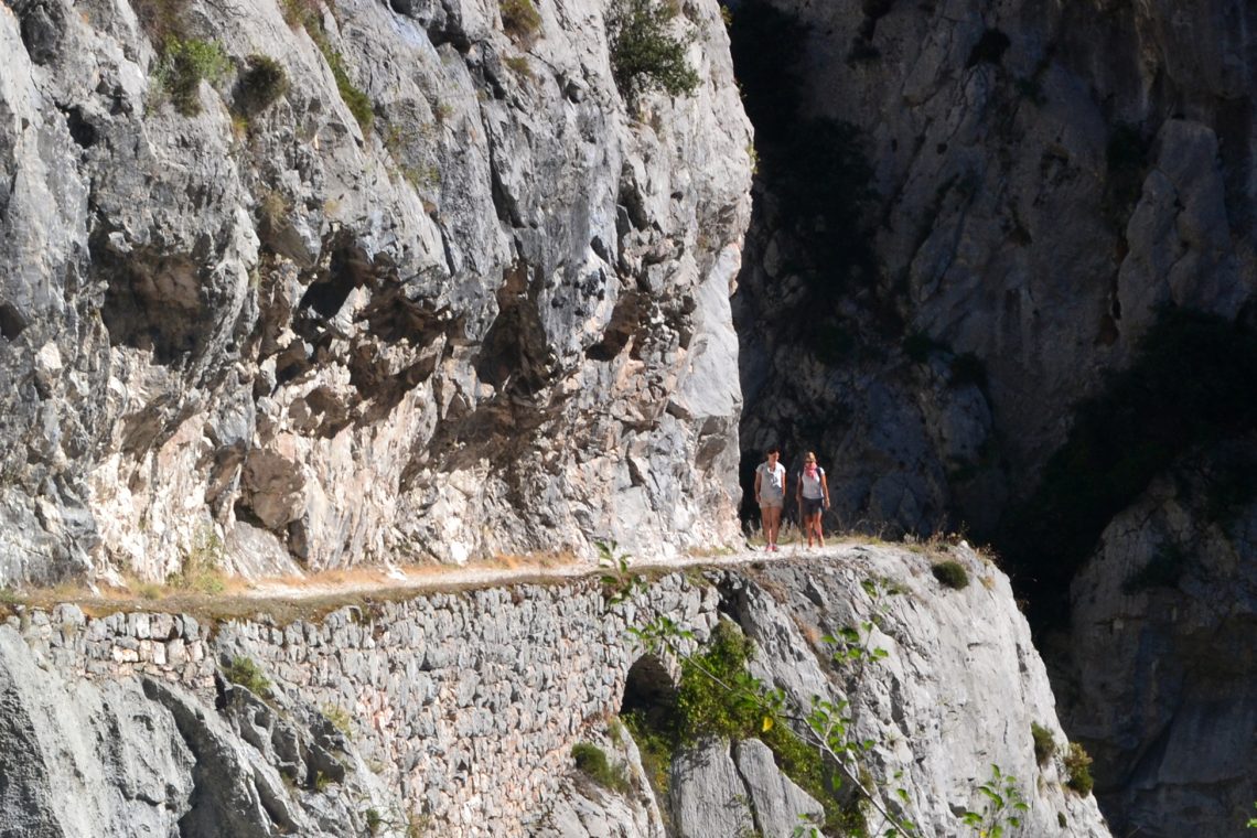
Above: The route is carved into the rock face
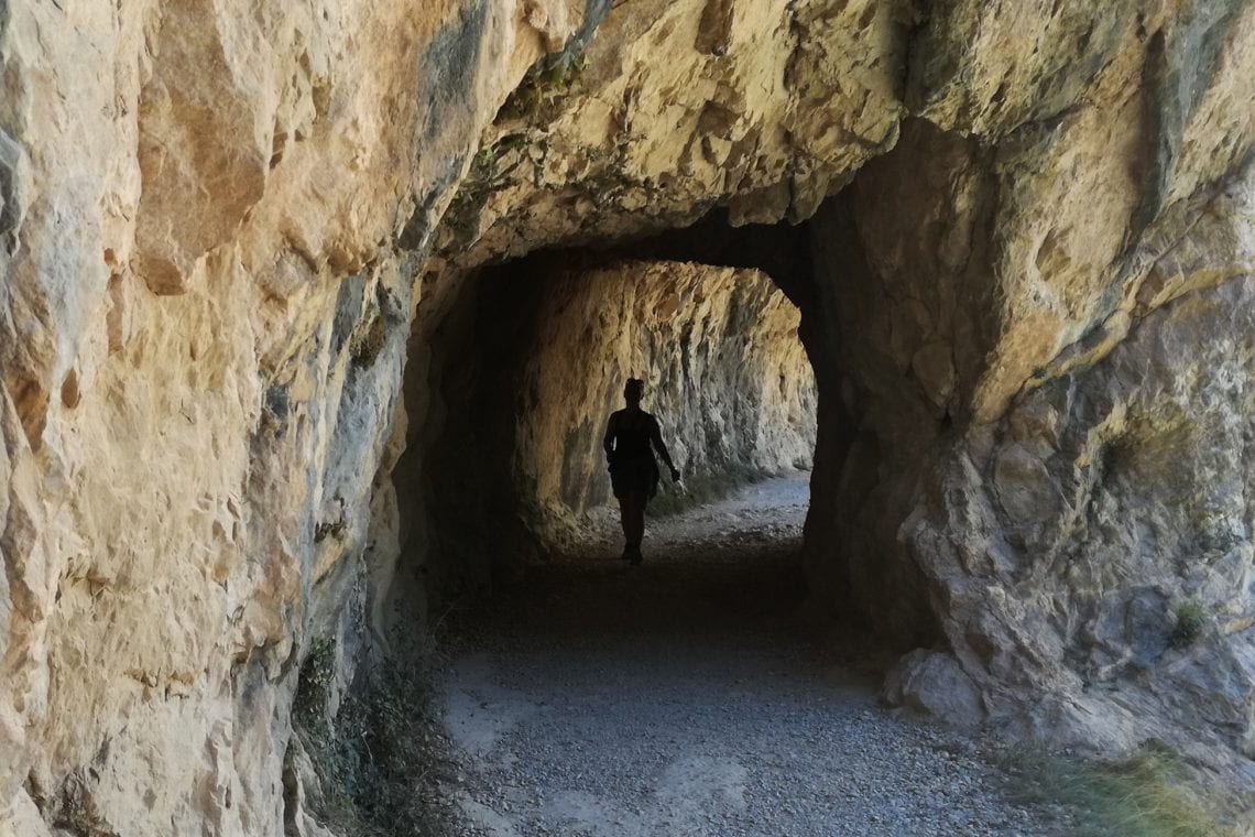
The deeper and deeper we go the more dramatic the landscape becomes. Tuffs of green vegetation break up the overly grey scene. The route being carved into the rock means that to one side is a steep fall, on the other a cliff face; often with overhangs and the occasional arch and tunnel. I gather the courage (I don’t like heights) to nervously look down the sheer drop to see the raging river below. Rushing water has been within earshot most of the time but due to being so high up in the winding gorge it’s not really easy to see.
Mountain goats with bells roam the lands here. It’s incredible how they feel right at home on such steep terrain with only crowds of trekkers disturbing their solitude. But they don’t seem to phased by us as we walk past. As the gorge continues to close in, and after about two hours the cliffs and overhangs are so steep that we’re now walking in tunnels which have been carved into the rock. They’re just long enough for us to become immersed in the absence of light just before a few further steps when our pupils need to readjust to the sunlight. I did have to crutch down a little while walking in these tunnels, holding my hand above my head to protect my head from smashing into the rock ceiling.
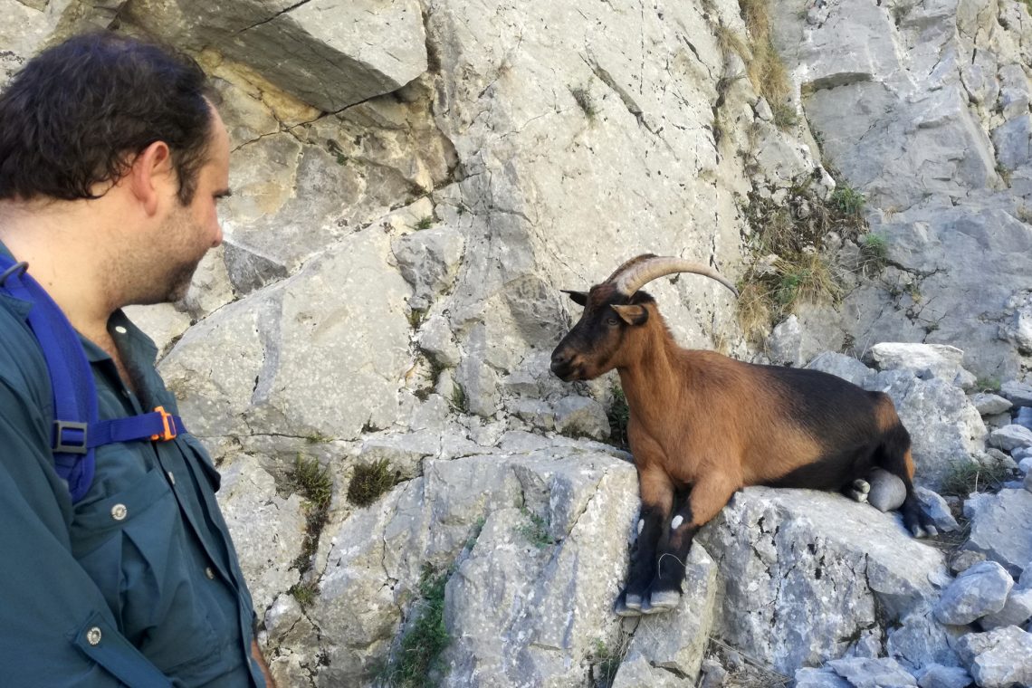
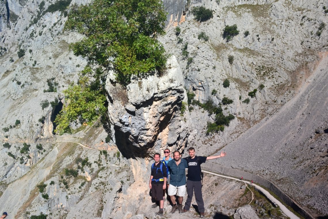
Above: Maz making friends | Absolutely stunning views
The path is narrowest here, and we’ve come up against more hikers; it’s the busiest part of the trail. This is probably due to the fact this is the most remarkable part of the environment, attracting visitors from the other end to which have started; walking up to these tunnels and back to the settlement of Cains (rather walking the full route). Water falls from the cliffs above and the spray provides us with a much needed cooling down. The water meets the sun and form a constant rainbow. Seeing such colour set against the dark rock and green algae with the deep blue sky above is really a treat.
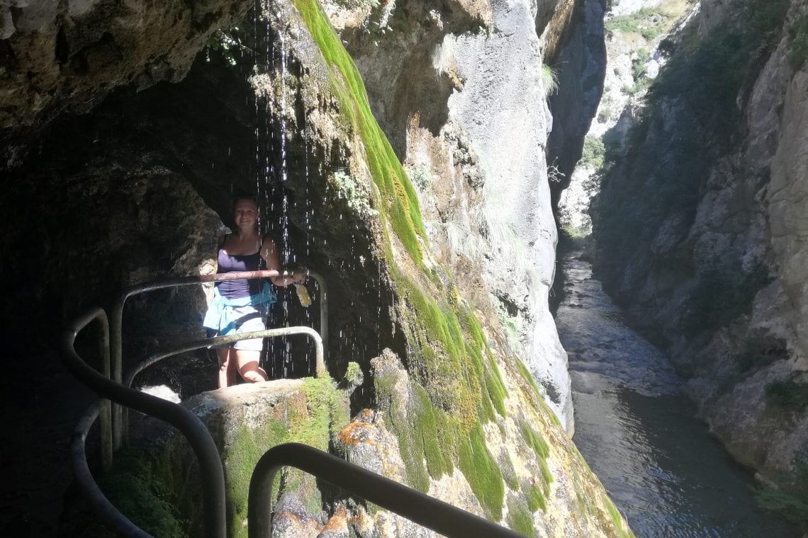
Above: Tunnels and fast flowing water as the gorge narrows
It’s just under three hours and we make it to Cains, just in time for lunch. Here the landscape opens up and is the perfect setting for the small settlement. Surrounded by mountains Cains has a few restaurants where visitors can replenish their energy with some tapas and traditional cider.
Cains has a road connection so it’s possible to get a ride back to Poncebos, but it’s a long way round, having to navigate largely around the mountain range it can actually take longer than walking back. So after dipping our feet in the very cold river we set off on a return trip. We retrace our route along the way we came. Whilst initially it’s not too hard going the afternoon sun starts to really take its toll, the heat reflecting from the surrounding rock is intense. There’s little breeze and we struggling to find some shade where we take a short break. We’re not the only ones who are straggling. As we walk along the cliff edge we see a yellow rescue helicopter fly past, and not far before us drop two medics via a winch to help a hiker who seems to have succumb to the heat. Soon after I’m amazed to see the helicopter come in for a landing a bit further down the trail on what looks like a naturally sculpted helipad and possibly the only bit of horizontal terrain anywhere in the canyon.
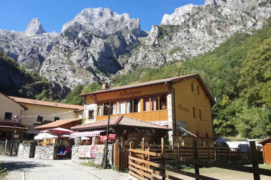
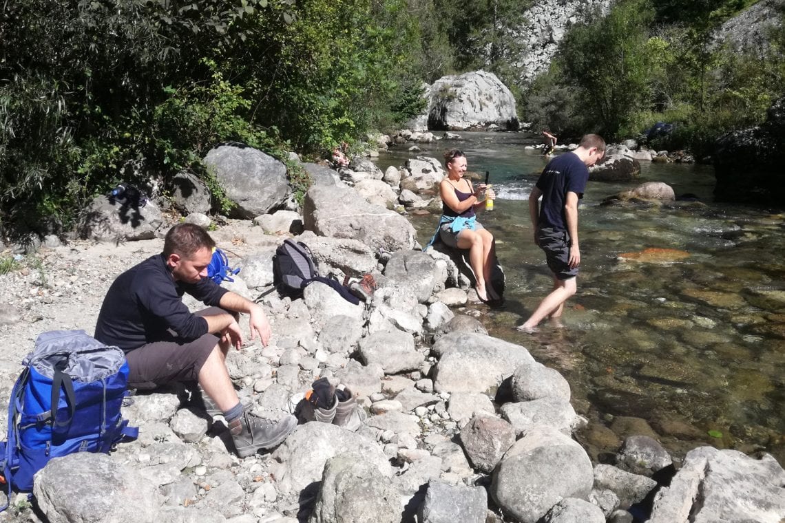
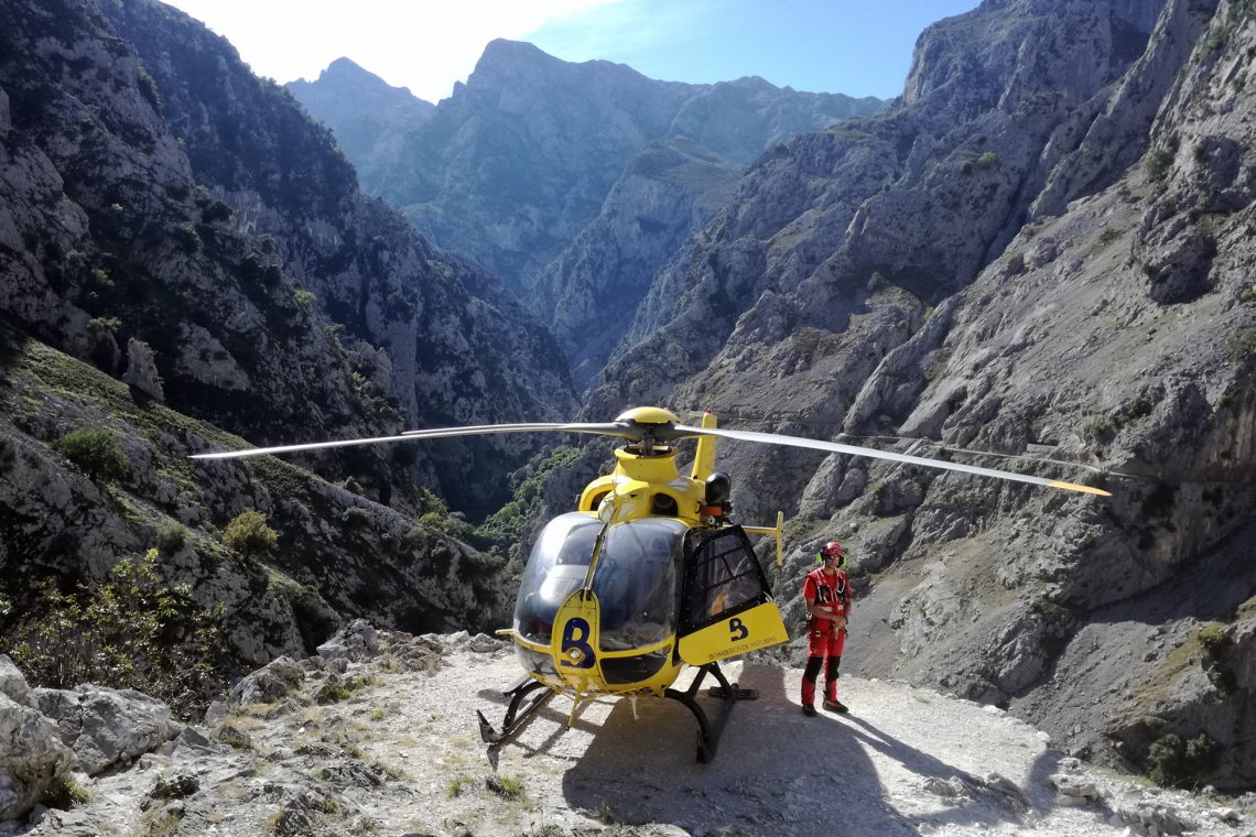
Above: At the end there are a couple of restaurants | Cooling down in the river | Surprised to witness a mountain rescue helicopter landing just before us
Three hours after we’ve started our return we’ve made it back to our starting point. Exhausted, soaked through with sweat and roasting hot we pile into our rental car to some much needed aircon. It really was hard work, the hard part being the return trip. We clocked up about 22 km in about six hours but it was the afternoon sun that really knackered us. But of course it was totally worth it. I know this was really was just a little teaser of what the ‘Picos’ have to offer but i’m hooked and i’ll definitely be returning to this area of natural outstanding beauty.
WHERE TO STAY
There are a number if villages where you can find accommodation. We stayed in Las Arenas.
USEFUL LINKS
- Website of the Picos de Europa National Park
- Tourism website of the Asturias region