Trip duration: 3 days | Approx cost: £400 | When: May – Sep
Doinit factor: A chance to plan your own exhibition!
Morocco has a lot to offer a traveller, particularly if they’ve a head for heights. Jbel Toubkal, the highpoint of the Atlas Mountain Range, is one of the top destinations for many. More often than not ascents are undertaken with organised trekking companies and while this can be a good option for some, what if you want to go it alone?
I often see treks advertised to mesmerising destinations, enticing me to sign up to a tour and thought to myself I would love to have a go if I had the disposable income, but what if I cut out the middle man and plan my trip independently. Toubkal would be my first chance to test my theory and see if I have what it takes to go it alone.
With any adventure, preparation and research are key. Fortunately these days the internet is a wealth of information, if you know where to look. I, of course, didn’t know where to look, so Google it was. I quickly found that when you enter “Toubkal” in to search engine it spits out pages upon pages of adventure companies offering guided trek packages. It’s easy to see why there is such an abundance of professionals offering their services. At 4,167m, Toubkal is the highest point of North Africa, there’s no real bureaucracy associated with a visit and its close proximity to Europe means the lure of this mountain can be irresistible for hikers and for big business. In an attempt to not contribute to this big business I wanted to summit Toubkal without the safety net, no support or comforts. Not just because I think I can do it at a fraction of the cost but because there‘s a greater sense of adventure to be had attempting this off my own back. After a few days of reading some of those elusive personal online blogs and tour operator’s schedules, I begin to gauge a feel for my upcoming trip and come up with my very own three day itinerary: Day 1) Arrive at Marrakesh Airport to head directly to the village of Imlil in the Atlas Mountains.Day 2) Trek from Imlil to the refuge.Day 3) Trek from the refuge to summit and then back to Imlil for a transfer to Marrakesh.
Now I have an idea of what I want to achieve it’s time for the practicalities. I choose a bank holiday weekend to arrive in Morocco (so less time to take off work) and begin to make preparations. It’s handy that both of the two refuges on the mountain are happy to answer any questions via email.I bombard them with questions. Will you be open? Do I need a reservation? How much will a night cost? Shall I bring a sleeping bag? How do I get to Imlil from the airport? A good idea is to also include a plan of what you want to do. That way they should be able to advise and offer any services you may need. Their replies reach my inbox within a couple of days. Each refuge offers to organise everything for me at a much lower price than the adventure companies. It seems organising a summit attempt to Toubkal is a lot simpler then I expect it to be (or want it to be, really). Both offer pick-ups from the airport, accommodation in Imlil (or Aroumed, the next village along) plus food, guides, donkeys and accommodation in Marrakesh. The elder of the two is the CAF (Club Alpine Francis) Toubkal Refuge, sometimes still referred to by its previous name, Neltner. Then there‘s the newer and locally owned Les Mouflons Refuge. With all this in mind deciding which one to stay in is quite difficult. There’s really little in it; I suspect you can’t go too wrong with either. Ultimately it will be down to price and my ability to haggle.
Before I finally commit I turn to my circle of friends to see who would like to journey to the top of North Africa with me. Of course whilst I do enjoy their company I must admit my ulterior motive: as a large group we’ll likely secure group discounts making this adventure more affordable for everyone. So in playing tour operator it’s not long before there’s a total of ten in our party. With final numbers confirmed we do indeed secure a reasonable offer from Les Mouflons. Payment will be in local cash on arrival.
Les Mouflons agree to organise our transfer and accommodation (half board) in Imlil. I politely decline their offer of guides and mules or donkeys. Instead our plan is to travel light, decant once at Imlil – leaving some baggage at our guest house – and then once more the next day at the refuge. We’ll be able to pick up our gear on the return journey.
Imlil is a popular destination for hikers so there’s plenty of opportunity to buy supplies, chocolate bars and water for the hike.
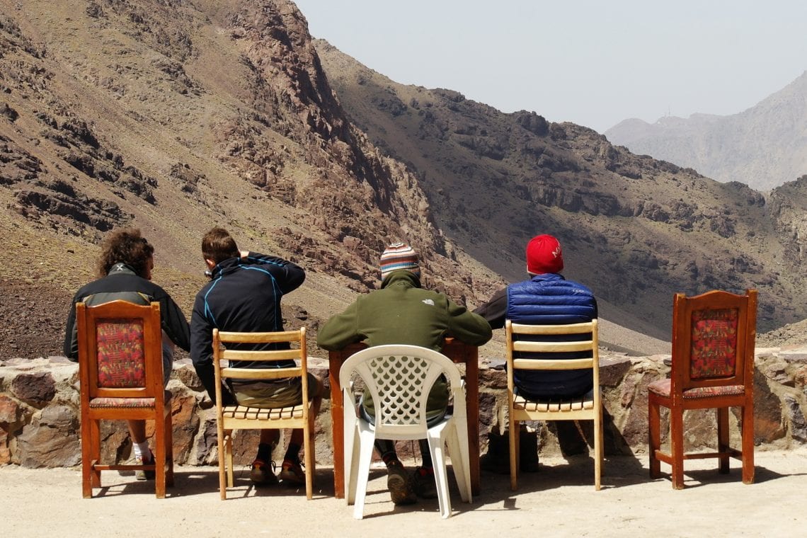
After weeks of planning the day of landing at Marrakesh Airport has arrived. With customs cleared and baggage collected it’s straight to the cash points to withdraw enough local currency to pay for our trip, plus some extra just in case. We find an older man holding up a sign for Les Mouflons Refuge and within ten minutes we’re in a white minibus heading for the Atlas Mountains. Imlil is only 70km away from Marrakesh but it can take over ninety minutes to get there due to the winding roads into the mountain range. Imlil is a popular destination for hikers so there’s plenty of opportunity to buy supplies, chocolate bars and water for the hike. This is where we are dropped off at a lovely Moroccan guest house (which works in partnership with the refuge) in time for evening tea. We’re at 1,740 metres above sea level as we watch the sun disappear behind the valley walls, sipping on our mint tea poured by our host, later followed by traditional Moroccan chicken couscous. It’s an early night, for tomorrow the hard work begins.
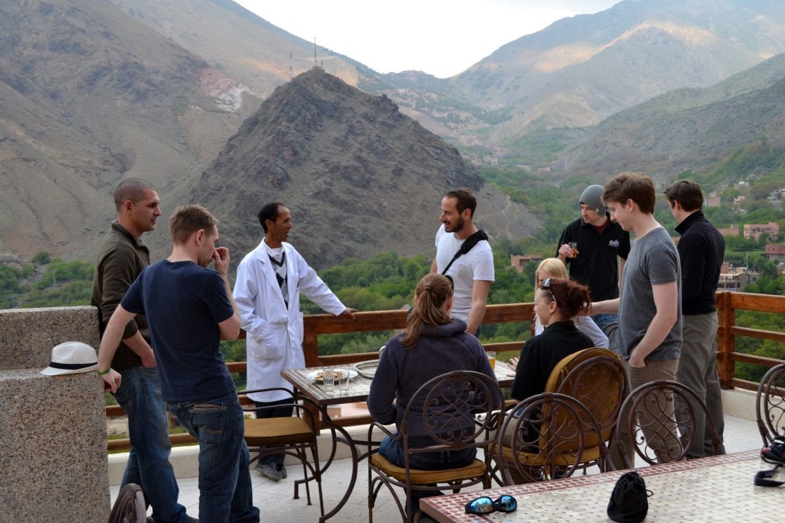
Above: Having tea with our host Ali in Imil the day before our climb
As we wake up in the morning at 8am there’s a substantial breakfast waiting for us on the terrace. Within an hour we are ready to leave. We’ve decanted and placed our larger bags in storage and head out towards Toubkal. We make our way to the start of the official trail through a forested section of Imlil with a few short switchbacks until we reach a track road above us hugging the valley wall. Then it’s about a kilometre along this track past Aroumed (the alternative to staying in Imlil for many visitors). From here is a short walk over a rock field which looks like a very wide dry river bed before we arrive at the start of the official trail.
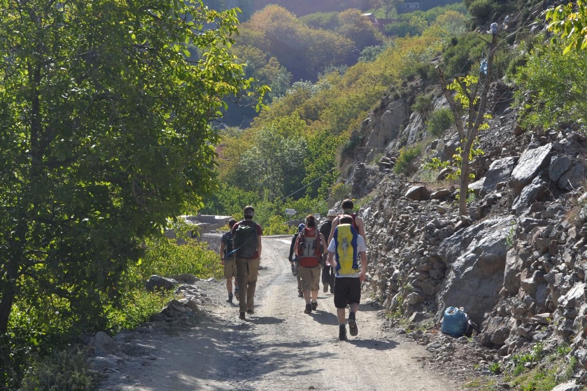
Above: The trail mostly runs over a dirt track towards the valley
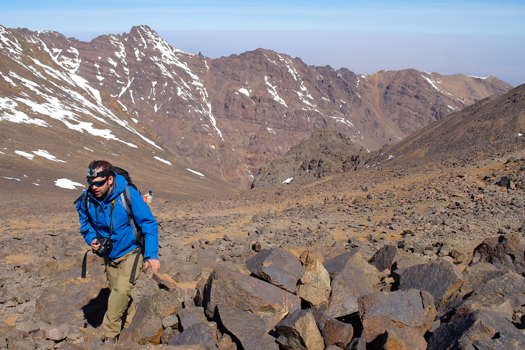
The trail is clearly defined and non-technical, following the left side of the Isougouane Valley. It’s dry and dusty but the base of the valley is very green presumably from all the melt water. It’s still early but the temperature is rising quickly. After a few minutes we’re drenched in sweat. Birds of prey circle high above, dark rocky ridges covered in patches of snow all to a backdrop of bright blue skies: it’s definitely worth the hard work, truly stunning. This section of the hike should take between four and five hours normally. Along our narrow route we frequently have to give way to passing donkeys carrying luggage and supplies for other hikers. I conceded that after a few hours I begin to question my idea of not hiring a couple of mules or donkeys for our gear. However, as we venture through the valley we do pass a handful of shacks selling freshly squeezed OJ, and bottle drinks cooled by melt water from the mountains.
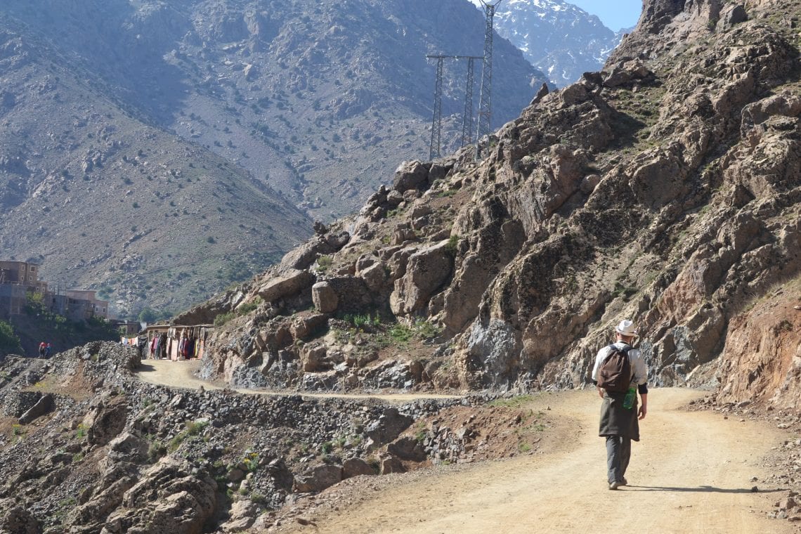
One of the great aspects of this trek is that there is no rush to get anywhere. There‘s not much point reaching the refuge early and with our 9am departure there is plenty of time before night fall. As the afternoon sun heats up the valley it becomes increasingly hot, even at our altitude of over 2000 meters. It doesn’t bear thinking how hot it will be in Marrakesh… Later we’re told +40 degrees Celsius is normal.Ahead are some buildings. As we approach we’re greeted by some friendly locals who tell us this is the settlement of Sidi Chamharouch. At its centre is a huge, white painted boulder though from a distance it looks like a giant snowball. This is the last populated area before the refuges.
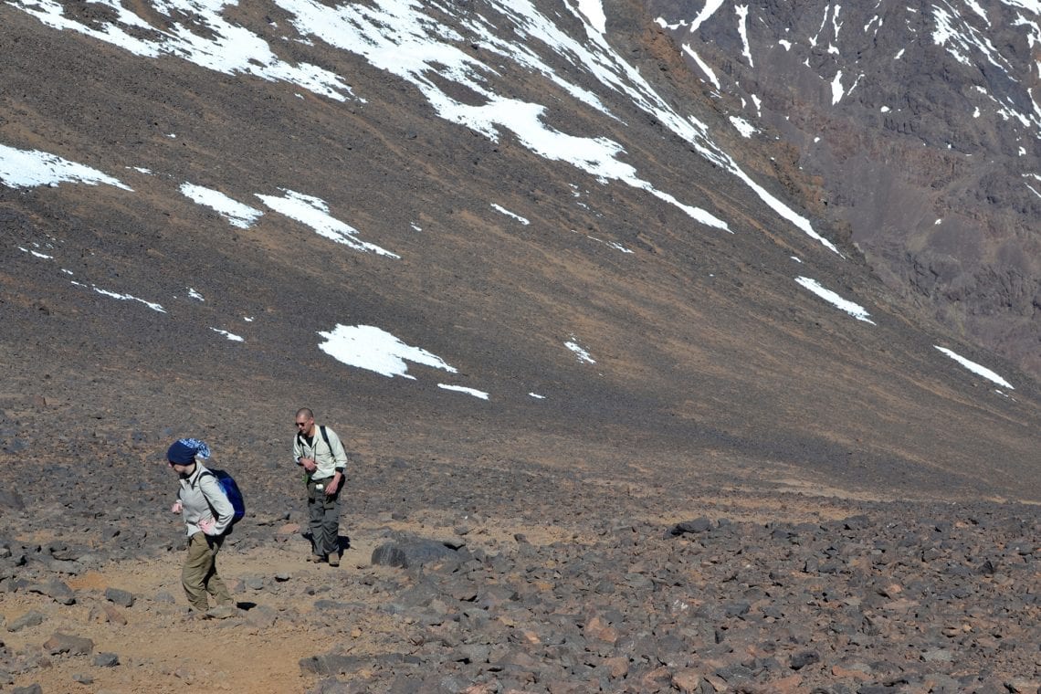
We receive a few waves, smiles and offers to come visit the shop but we polity refuse and carry on. Then it‘s over a bridge facing a waterfall and on to a handful of switch backs where we gain altitude substantially compared to the last couple of hours. Personally I hate switchbacks but they aren’t too repetitive. It’s not long before we’re back to a gradual rock track.The trail gets narrower and as well as more rocky here though there are still large patches of grass being grazed by mountain goats. The difference in temperature is now noticeable and our sweat begins to feel really cold after only a few minutes of rest. The elevation also means the air is thinner and a few of our party begin to complain of headaches. The pace slows and moral declines.
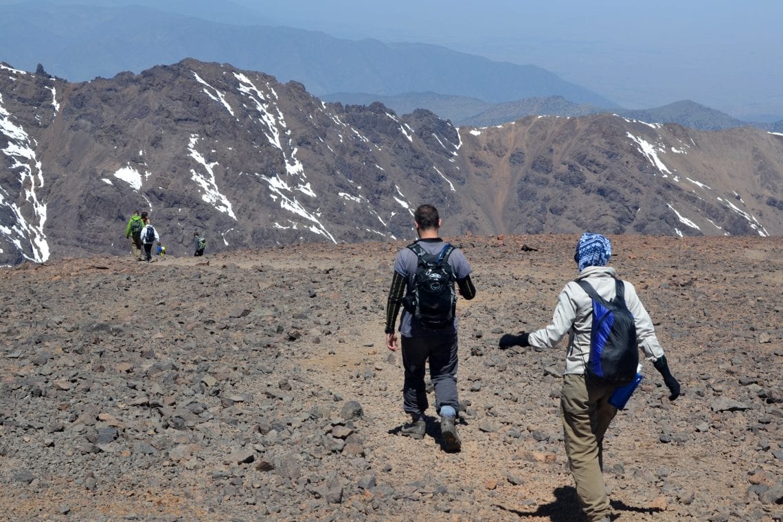
Above: As the trail gets steeper and more remote it’s starting to feel like a ‘real’ expedition
The route snakes deeper and deeper into the Atlas Mountains, continually obscuring a straight line of sight to our destination. As we make our way past each bend our hopes of seeing the refuges in the distance spike then fade away. It’s another hour and half before the welcome sight of the Refuges, though once in sight they continually disappear and reappear as the route drops and rises. We’re still about 30 minutes away.
At 3,200 meters we arrive at the refuge. It’s a cliché to say it’s a sight for sore eyes, but it’s true. The last few hours have been hard going. By now I have a splitting headache. All I want to do is lay down with a bottle of cola; fortunately the refuge has a well stocked tuck shop. The refuge is a grand building, but quite dark inside. The thick walls and a few small windows isolate it from the harsh winter but in the warmer months they keep any heat out. Even now in the summer we witness a hail storm just before dinner. The refuge is not warm but perhaps the exhaustion is making us all feel it even more. There’s a communal room with a stove radiating heat where a handful of other hikers are resting their feet. We join them, exchanging stories and looking for someone who’s been at the summit so they can tell us what awaits. One couple tell us it’s incredibly difficult but then again another group tell us they found it easier than the hike up to the refuge, so we’re still pretty much in the dark as to know what to expect.
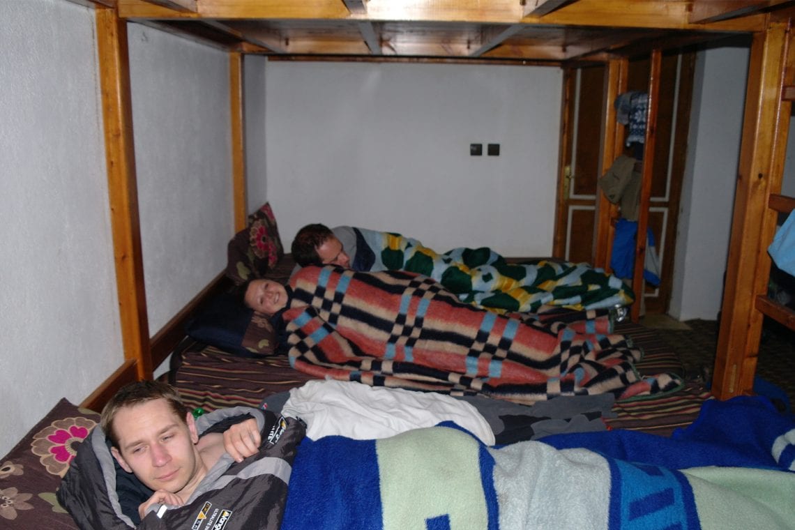
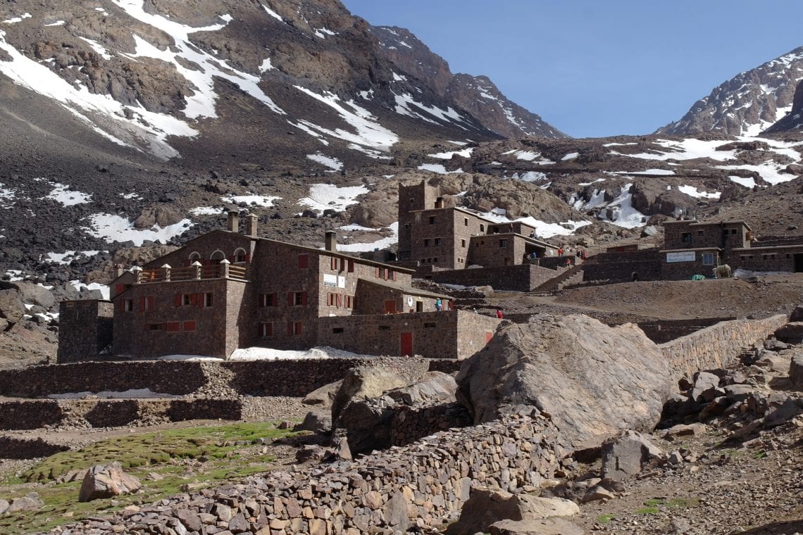
Above: The refuge stands proudly deep in the valley | Bunking up in our dorm | With views like this who needs at TV
We sit down for our 7pm dinner in the nicely heated dining room for some turkey chops. I ask our group if anyone noticed any turkeys around. It’s a unanimous no. All supplies here must make the long journey to the refuge by donkey from Imlil. After dinner it’s not long before we head to our dormitory, where again we decant to yet smaller packs. Electricity only runs for a few hours in the evening with lights out at about 10.30pm. Be warned, a torch is handy should midnight visits to the toilets be required. The night in the refuge is cold. I wish I had brought my sleeping bag but the refuge’s blankets have to suffice. Falling asleep at 3,200metes is a somewhat peculiar experience as you really have the time and absolute silence to notice how one’s breathing is different, unfamiliar from what you’ve become use to hearing when falling asleep back home.
Our alarms go at 5.30am for our 6am breakfast provided by the refuge; again we’re cold and looking forward to a glass of hot mint tea to warm us up. There are showers but I’m convinced they’d be too cold to stomach, beside I’m sure after five minutes out the door I’ll have sweated enough to negate the purpose of a shower.
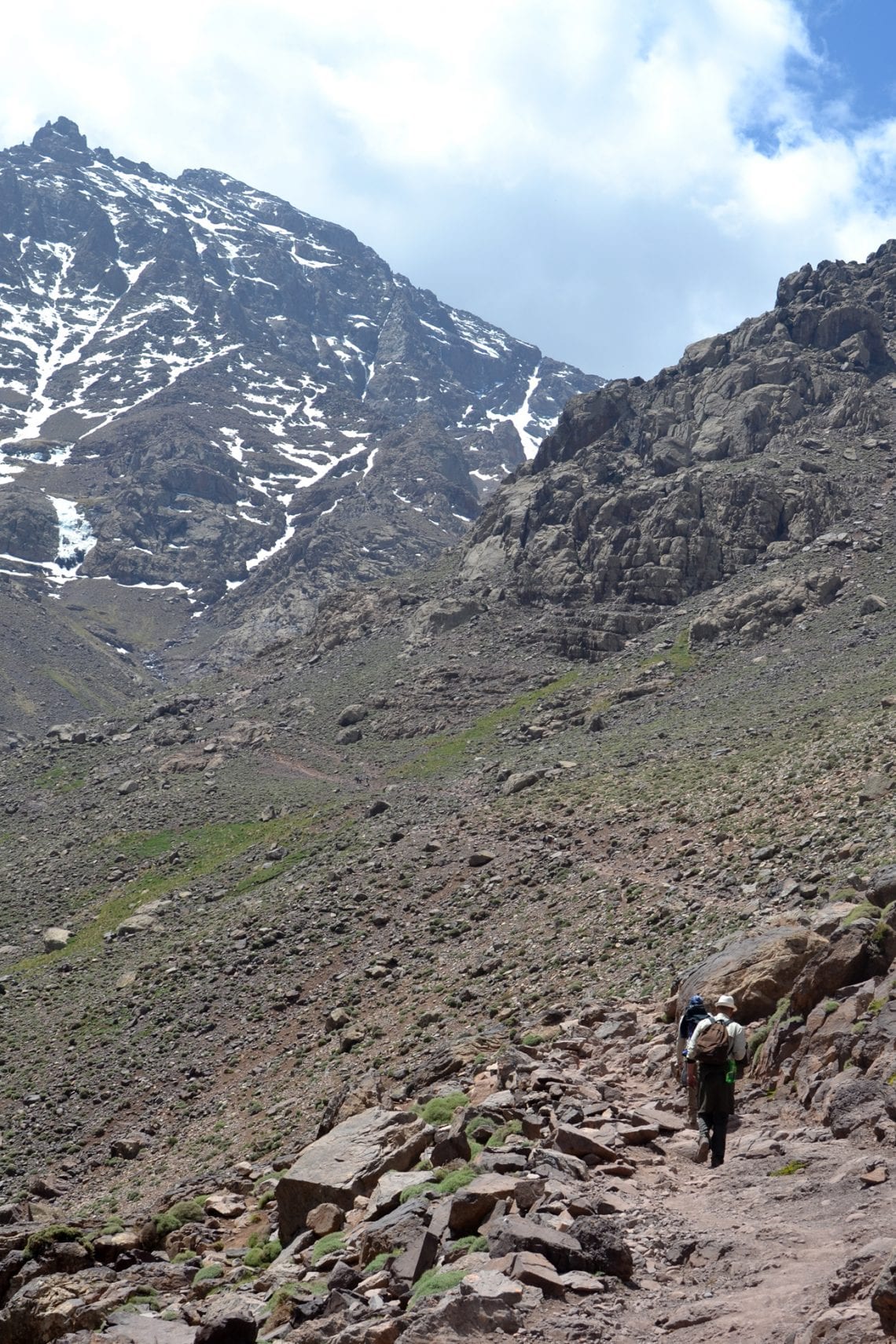
Instantly the morning trek feels completely different from the ground we’ve covered so far. Just past the refuge we bridge a fast-flowing stream and are then faced with a steep and loose scree slope. This is the southern cwm, starting off at an approximately 45 degree angle. The route isn’t obvious, only red markers painted on the rock and occasional graffiti give an indication which way to head upwards. With each step we hear rocks rolling downward. The morning sun remains hidden behind the surrounding peaks; if it weren’t for the physical exertion we’d probably be quite cold.
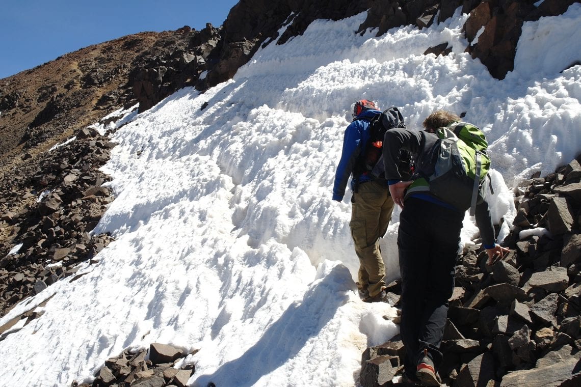
Above: As we gain altitude it’s a slow pace up the steep rocky terrain with occasion navigating snow and ice
It’s easy to go off route here; in fact we encountered plenty of people telling us they’d had to double back as they went in the wrong direction. This same mistake was made by the faster members of our team who pushed further ahead only to realise they were on wrong side of the cwm meaning a slow traverse side track back on route. Though they’re only about 100m away it takes an hour before we are reunited.
The south cwm eventually begins to level out with only boulders covered in ice left to negotiate. By now we’re within the snowline. Though much of the snow has melted away frozen patches the size of football fields still need to be crossed. Fortunately we are able to follow well-trodden footprints made in the proceeding days. At times three point contact is needed and the snow is frozen solid. If you’re not wearing gloves your hands feel the burn.
Above: Reaching the top of the south cwm
Reaching then end of the cwm is mentally rewarding and we can afford ourselves a short break to take in the view. This is the first time we’ve been able to see beyond the mountain range, south into the Sahara. From here on it’s a left turn to face a false peak, up its loose scree for about twenty minutes where you can finally see the well-recognised metal pyramid marker of the summit of Jbel Toubkal in the distance. There’s little altitude to gain from here as we traverse a ridge before making it to that small plateau at the top of North Africa. By know the low level of oxygen at his altitude has taken its toll on all 10 of us (before now I’ve only reached 3718 Meters). Everyone complains of throbbing headaches, we’re all out of breath as we slowly make our way to the summit marker. Everything seems more difficult than it needs to be and 1.5our stride begins to resemble that of zombies rather than hikers. Staying the night at the refuge is meant to help with acclimatisation. If we’d decided the press on to attempt the summit in one day, then there’s no telling how worse we could feel, or worse – what mistakes or misjudgements could creep in.The sights at the peak are spectacular, despite a haze along the horizon you can see far into the flat lands of the Sahara. There’s a real sense of camaraderie, we congratulate each other, there’s even an odd tear from some of the group.
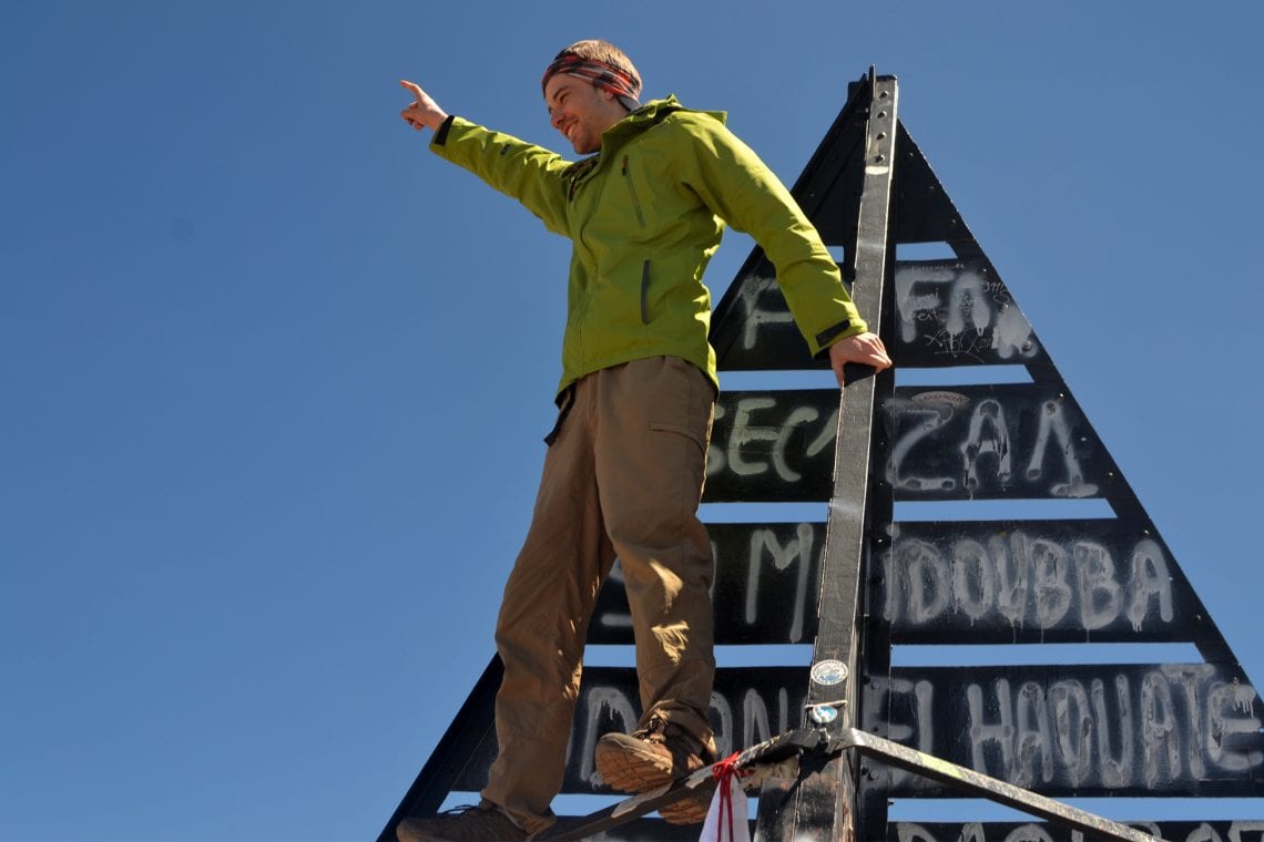
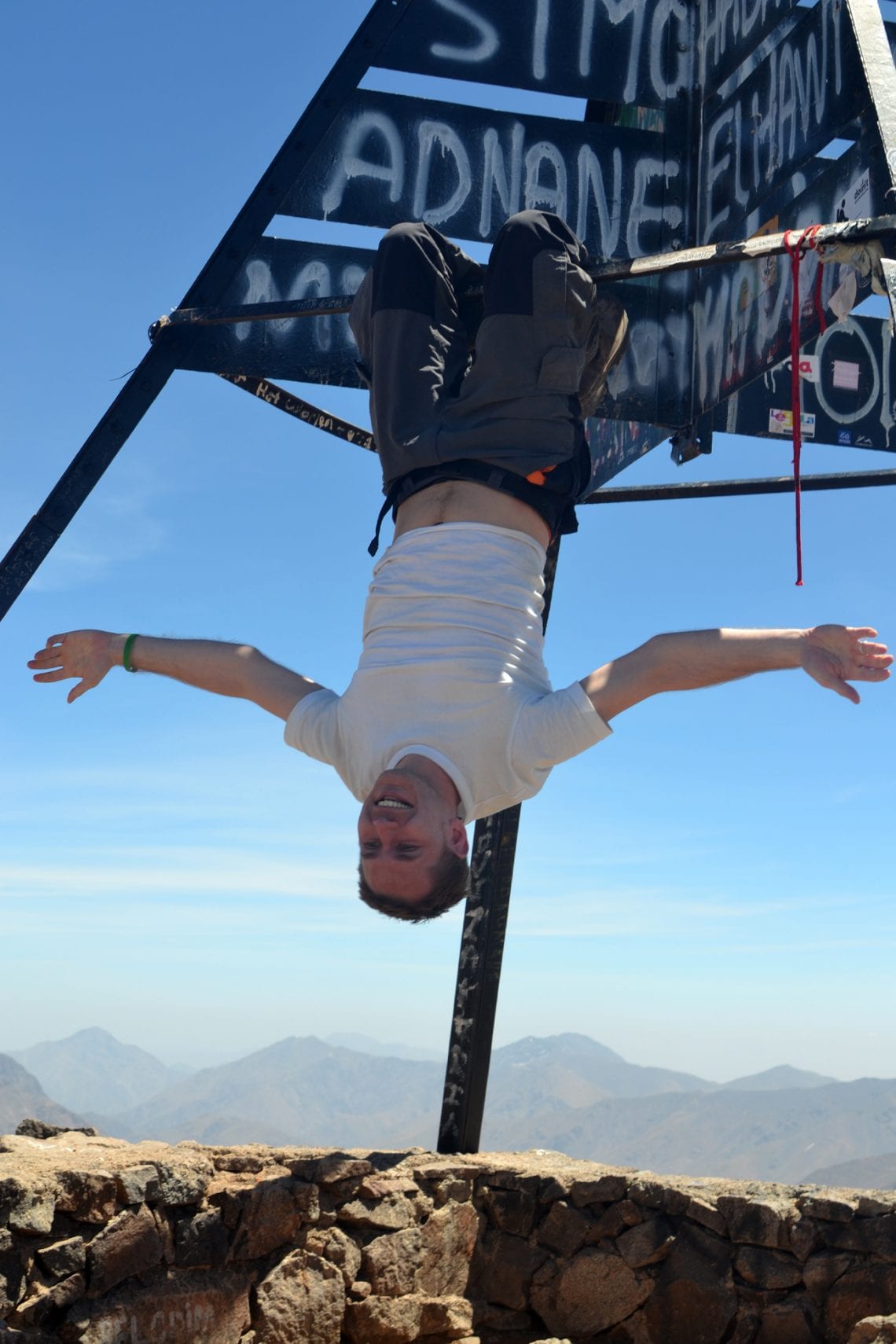
Above: We finally made it to the top of North Africa | A trig point marks the official peak

Organised or Independent
The internet is full of companies offering their services but if you’re interested in a no-nonsense budget summer adventure then you can trek independently. Contact one of the two refuges for specific info. By working directly the Les Mouflons Refuge this adventure cost us less than half the price of the cheapest advertised organised trip found online.
WHERE TO STAY
There are two refuges on the mountain:
The village of Imlil has a number of accommodation options.
USEFUL LINKS
- Summit post: Toubkal
- Website of Toubkal National Park